


Absolute Cavity Radiometer
An instrument used for very accurate measurements of solar irradiance. Absolute cavity
radiometers absorb radiation on a blackened conical receiver and are electrically
self-calibrating. Absolute cavity radiometers determine the solar constant and provide
the reference from which other radiometers are calibrated.
Absolute vorticity
(or Total Vorticity) of air particles at any particular point is comprised of two
elements: (i) on the rotating earth, air adopts the local vorticity due to the earth's
solid-body rotation about its pole-to-pole axis, which is latitude dependent, and
is known as the Coriolis parameter. This increases to a maximum over the poles and
decreases to zero at the equator. The Coriolis rotation sense is always positive
(or zero). (ii) the other element is known as the relative vorticity, the 'spin'
tendency of air particles due to their motion relative to the earth - driven by
atmospheric forces. Relative vorticity can be either positive (cyclonic sense) or
negative (anticyclonic).
AC
 (Altocumulus cloud.) Composed of flattened thick, gray, globular
masses, this middle cloud genus is primarily made of water droplets. In the mid-latitudes,
cloud bases are usually found between 8,000 and 18,000 feet. A defining characteristic
is its layer effect, often with a wavy billowy appearance, giving it the nickname
of "sheep" or "woolpack" clouds. Sometimes confused with cirrocumulus clouds, its
elements (individual clouds) have a larger mass and cast a shadow on other elements.
It may form several sub-types, such as altocumulus castellanus or altocumulus lenticularis
Virga may also fall from these clouds. White and/or gray patches, sheets, or layers
of clouds generally with shading composed of rounded masses or rolls, which are
sometimes partially fibrous or diffuse and which may or may not be merged. Altocumulus
clouds exist in the mid level of the sky between 2 to 6 kilometres above the ground
(in meteorology, the prefix alto is used with other cloud types to describe other
mid-level clouds as well). They are one of four genera that are hybrids of cumulus
clouds.
Accast
 (Altocumulus Castellanus or Castellatus) abbreviation 'Ac cas' These
are medium level clouds (between circa 8000 and 18000 ft; 2.5 to 5.5 km) which exhibit,
at least in their upper parts, marked cumuliform / turreted appearance - the convective
towers are often taller than the width of the individual base; the bases are connected
and often appear to be arranged in lines or streets. These clouds are a good indicator
of medium level instability and high moisture content - and often the precursor
for widespread thundery activity within the following 24 to 48 hours. Observers
used to SYNOP coding may also refer to these (along with Altocumulus floccus/Ac
flo), as CM8 clouds.
Accessory cloud
A cloud form that is dependent, for its formation and continuation, upon the existence
of one of the major cloud genera. It is often an appendage of the parent cloud (as
mamma, incus, tuba, arcus), but it also may be an immediately adjacent cloudy mass
(as pannus, pileus, velum).
Acid Precipitation
Precipitation such as rain, snow or sleet, containing relatively high concentrations
of acid-forming chemicals and having elevated levels of hydrogen ions (low pH).
It can have harmful effects on plants, aquatic animals and infrastructure. Acid
rain is caused by emissions of sulfur dioxide and nitrogen oxide, which react with
the water molecules in the atmosphere to produce acids. Nitrogen oxides can also
be produced naturally by lightning strikes and sulfur dioxide is produced by volcanic
eruptions. The chemicals in acid rain can cause paint to peel, corrosion of steel
structures such as bridges, and erosion of stone statues.
Adiabatic
A process where temperature changes occur in a 'system', without heat being supplied
to, or lost from that system. In meteorology, used in connection with changes involving
air parcels moving vertically in the atmosphere. [If heat exchange is involved,
the process is non-adiabatic (or diabatic)].
Adiabatic lapse rate
The variation of temperature with height of an air parcel lifted adiabatically from
the surface.
Advection
The horizontal transfer of any property in the atmosphere by the movement of air
(wind). Examples include heat and moisture advection. In meteorology and oceanography,
advection often refers to the transport of some property of the atmosphere or ocean,
such as heat, humidity or salinity. Advection is important for the formation of
Orographic clouds and the precipitation of water from clouds, as part of the hydrological
cycle.
Advection Fog
Fog that develops when warm moist air moves over a colder surface, cooling that air
to below its dew point.
Aerosol
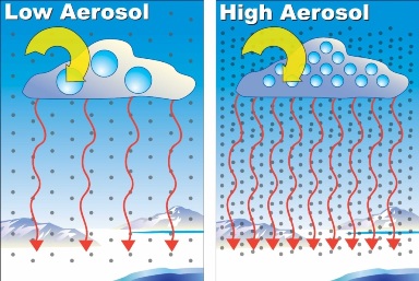 The atmospheric aerosol is a complex and dynamic mixture of solid and liquid particles
from natural and anthropogenic sources. The natural background aerosol is present
in the absence of human activity, while the urban aerosol is dominated by anthropogenic
sources. In both cases, primary particles are continuously emitted into and secondary
particles are formed in the atmosphere. The atmospheric aerosol has a profound effect
on our lives. Urbanised cities face lot of health problems which are mainly caused
due to the presence of Aerosol in the air.
Air Mass
In meteorology, an air mass is a volume of air defined by its temperature and water
vapour content. Air masses cover many hundreds or thousands of square miles, and
adopt the characteristics of the surface below them.
Air Mass Thunderstorm
Generally, a thunderstorm not associated with a front or other type of synoptic-scale
forcing mechanism. Air mass thunderstorms typically are associated with warm, humid
air in the summer months; they develop during the afternoon in response to insolation,
and dissipate rather quickly after sunset. They generally are less likely to be
severe than other types of thunderstorms, but they still are capable of producing
downbursts, brief heavy rain, and (in extreme cases) hail over 3/4 inch in diameter.
Since all thunderstorms are associated with some type of forcing mechanism, synoptic-scale
or otherwise, the existence of true air-mass thunderstorms is debatable. Therefore
the term is somewhat controversial and should be used with discretion.
Albedo
The ratio of the amount of radiation reflected from an object's surface compared
to the amount that strikes it. This varies according to the texture, colour and
expanse of the object's surface and is reported in percentage. Surfaces with high
albedo include sand and snow, while low albedo rates include forests and freshly
turned earth.
AMSL
The term “Above Mean Sea Level” (AMSL) is the elevation or altitude
of any object, relative to the average sea level. AMSL is used in aviation, where
most heights are recorded and reported in AMSL . In atmospheric sciences, it tells
how high a point is above the average level of the oceans. (For example, an ocean
beach would be at 0 AMSL.)
Anabatic wind
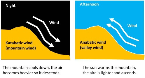 A wind that is created by air flowing uphill. Valley breezes, produced by local daytime
heating, are an example of these winds. The opposite of a katabatic wind.
Ana-front
When warm air ascends relative to the cold air at a frontal surface, the front is
said to be an Ana-front. Such fronts are normally 'active', in that thick/precipitation
producing clouds (possibly with embedded instability), are usually located in the
warm air associated with both a warm and cold front.
Anticyclone
An area of pressure that has diverging winds and a rotation opposite to the earth's
rotation. This is clockwise the Northern Hemisphere and counter-clockwise in the
Southern Hemisphere. It is the opposite of an area of low pressure, or a cyclone.
Anticyclonic rotation
Rotation in the opposite sense as the Earth's rotation i.e., clockwise in the Northern
Hemisphere as would be seen from above. The opposite of cyclonic rotation.
Anticyclonic trough disruption If the northern (southern in the southern hemisphere) portion of an upper trough moves forward and warms out, leaving a quasi-stationary cut-off low in the base of the trough, the process is described as anticyclonic trough disruption - because the net result is a strong build of pressure/new high cell formation behind the retreating trough.
AP
Anomalous Propagation. Radar term for false (non-precipitation)
echoes resulting from nonstandard propagation of the radar beam under certain atmospheric
conditions.
Arctic Oscillation
The Arctic oscillation (AO) or Northern Annular Mode/Northern Hemisphere Annular
Mode (NAM) is an index (which varies over time with no particular periodicity) of
the dominant pattern of non-seasonal sea-level pressure variations north of 20N
latitude, and it is characterized by pressure anomalies of one sign in the Arctic
with the opposite anomalies centred about 37–45N.
Arcus
A low, horizontal cloud formation associated with the leading edge of thunderstorm
outflow (i.e., the gust front ). Roll clouds and shelf clouds both are types of
Arcus clouds.
Arid
A term used for an extremely dry climate. The degree to which a climate lacks effective,
life-promoting moisture. It is considered the opposite of humid when speaking of
climates.
AS
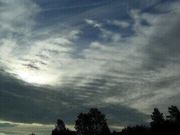 “AltoStratus” This middle cloud genus is composed of water droplets,
and sometimes ice crystals. In the mid-latitudes, cloud bases are generally found
between 15,000 and 20,000 feet. White to gray in colour, it can create a fibrous
veil or sheet, sometimes obscuring the sun or moon. It is a good indicator of precipitation,
as it often precedes a storm system.
High, sheet-like (layered) clouds which are found at an average height of about
3,000 meters (10,000 feet) or 1,700 to 6,000 meters (6,000 to 20,000 feet). They
appear fibrous, striated, or lightly striped. The clouds are composed of water droplets
and/or ice crystals (unlike the higher cirrostratus which are primarily made up
of ice crystals).
ASOS
“Automated Surface Observing System”. This system is a collection
of automated weather instruments that collect data. It performs surface based observations
from places that do not have a human observer, or that do not have an observer 24
hours a day.
Asynoptic
Over the many years that operational meteorology has developed, certain hours have
been designated 'synoptic' hours, and observation times standardised around these
points; the MAIN synoptic hours currently being 00, 06, 12 and 18 UTC(formerly GMT),
with intermediate hours at 03, 09, 15 and 21 UTC. Increasingly however, observing
systems (e.g. satellite, radar-networks, drifting buoys etc.) provide data at times
other than these 'fixed hours' - these are designated non, or 'asynoptic' observations.
NWP models can assimilate these observations during the initialisation process.
AVN
AViatioN model; one of the operational forecast models run at NCEP. The AVN is run
four times daily, at 0000, 0600, 1200, and 1800 GMT.
AWOS
“Automated Weather Observing System” is the term mainly used in
Aviation Meteorology. It is an automatic system similar to ASOS but has more recording
sensors such as visibility and cloud height. The system also generates METAR and
SPECI warnings required for aviation operations.
Backing
A change in wind direction that shifts counterclockwise in the Northern Hemisphere
at a certain location. In the Southern Hemisphere, it is clockwise. This can either
happen in the horizontal or the vertical (with height). For example, the wind shifts
from the northeast to the north to the northwest. It is the opposite of veering.
Backing wind
In the Northern Hemisphere a wind that rotates in the counter clockwise direction
with increasing height. Opposite of veering wind.
Baroclinic
It is a description of an atmospheric condition in which constant pressure surfaces
intersect surfaces of constant temperature. In weather analysis, a Baroclinic atmosphere
exists when isotherms exist in an isobaric surface analysis. In a Baroclinic atmosphere,
there is a horizontal temperature gradient and variation with height of the geostrophic
wind (thermal wind).
Baroclinic zone
A region in which a temperature gradient exists on a constant pressure surface. Baroclinic
zones are favoured areas for strengthening and weakening systems; Barotropic systems,
on the other hand, do not exhibit significant changes in intensity. Also, wind shear
is characteristic of a Baroclinic zone.
Barometric Pressure
The pressure (force per area) created by the weight of the atmosphere, measured by
a barometer. At higher elevations, the atmospheric pressure is lower because there
is less air.
Barotropic
That part of the velocity field that is either uniform with depth or has zero horizontal
component of vorticity. In a purely barotropic flow, the pressure gradients and
the density gradients are parallel so that their cross product, the baroclinic torque
vector, is zero. Variations of fluid density are therefore not directly relevant
to barotropic motion.
Baseflow recession
A recession curve of streamflow so adjusted that the slope of the curve represents
the runoff depletion rate of the groundwater.
A curve is formed by the observed hydrograph during prolonged periods of no precipitation.
Bidirectional Reflectance
A term for the amount of reflected radiation compared to the amount of incident radiation,
or albedo, of a surface. The surface is not perfectly specular. That is, the reflected
intensity is not at the same angle with respect to the surface normal as the incoming
rays, nor are the two intensities necessarily equal (in crude terms, when light
bounces off the Earth, some of it is absorbed and the rest of it bounces "funny",
not as it would off a mirror).
BL
"Boundary layer", The lowest layer of the earth's atmosphere, usually
up to 3,300 feet, or one kilometer, from the earth's surface, where the wind is
influenced by the friction of the earth's surface and the objects on it.
Blizzard
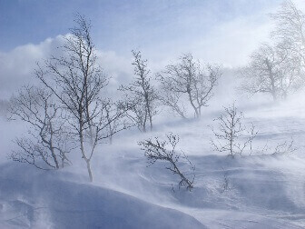 A severe weather condition characterized by low temperatures, winds 35 mph or greater,
and sufficient falling and/or blowing snow in the air to frequently reduce visibility
to 1/4 mile or less for a duration of at least 3 hours. A severe blizzard is characterized
by temperatures near or below 10°F, winds exceeding 45 mph, and visibility reduced
by snow to near zero.
Bomb
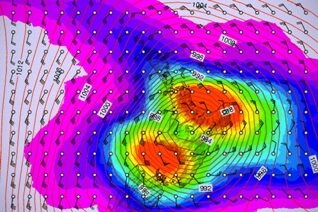 Explosive Cyclogenesis (also referred to as a weather bomb, meteorological bomb,
explosive development, or bombogenesis) refers in a strict sense to a rapidly deepening
extratropical cyclonic low-pressure area. To enter this category, the central pressure
of a depression at 60˚ latitude is typically taken to decrease by 24 hPa or more
in 24 hours. This is a predominantly maritime, cold-season (winter) event, but also
occurs in continental settings. They are the extra-tropical equivalent of the tropical
rapid deepening.
Broadband Solar Irradiance
Theoretically the solar radiation arriving at the earth from all frequencies or wavelengths,
in practice limited to the spectral range of radiometers, typically from 300 nm
to 3000 nm wavelength. Meteorologists refer to this band as short-wave radiation.
Bright band effect
The highly reflective melting snow will appear to the ground weather radar as more
intense precipitation than it actually is. This is what is known as the bright band
effect (an effect of high intensity of rainfall as it passes through the melting
level).
Bubble High
A bubble high (sometimes called a "mesohigh") is a mesoscale high-pressure area that
forms beneath thunderstorms. While not always the case, it is usually associated
with a mesoscale convective system. In the early stages of research on the subject,
the mesohigh was often referred to as a "thunderstorm high".
Buys Ballot's Law
Describes the relationship of the horizontal wind direction to the pressure distribution.
In the Northern Hemisphere, if one stands with one's back to the wind, the pressure
on one's left is lower than the pressure on one's right. It is reversed in the Southern
Hemisphere. This law was named after the Dutch meteorologist, Buys Ballot, who developed
the formula in 1857.
BWER
The Bounded Weak Echo Region, also known as a BWER or a vault, is a radar signature
within a thunderstorm characterized by a local minimum in radar reflectivity at
low levels which extends upward into, and is surrounded by, higher reflectivity
aloft. This feature is associated with a strong updraft and is almost always found
in the inflow region of a thunderstorm. It cannot be seen visually. The BWER has
been noted on radar imagery of severe thunderstorms and has a lightning detection
system equivalent known as a lightning hole.
CA
( Cloud to Air: Lightning ) that occurs when the air around a positively
charged cloud top reaches out to the negatively charged air around it.
Calibration (radar)
As well as de-cluttering for permanent echoes, and other adjustments, rainfall radar
returns are calibrated (in real-time) against a network of telemetering rain gauges.
This means of course that if the return is over areas without rain gauges (e.g.
the sea), over-reading can occur, and caution is needed in blindly following radar
imagery to assess rainfall rates/accumulations for this reason.
Cap (or Capping Inversion)
A layer of relatively warm air aloft (usually several thousand feet above the ground)
which suppresses or delays the development of thunderstorms. Air parcels rising
into this layer become cooler than the surrounding air, which inhibits their ability
to rise further. As such, the cap often prevents or delays thunderstorm development
even in the presence of extreme instability . However if the cap is removed or weakened,
then explosive thunderstorm development can occur.
The cap is an important ingredient in most severe thunderstorm episodes, as it serves
to separate warm, moist air below and cooler, drier air above. With the cap in place,
air below it can continue to warm and/or moisten, thus increasing the amount of
potential instability. Or, air above it can cool, which also increases potential
instability. But without a cap, either process (warming/moistening at low levels
or cooling aloft) results in a faster release of available instability - often before
instability levels become large enough to support severe weather development.
CAPE
Convective Available Potential Energy. A measure of the amount of
energy available for convection. CAPE is directly related to the maximum potential
vertical speed within an updraft; thus, higher values indicate greater potential
for severe weather. Observed values in thunderstorm environments often may exceed
1,000 joules per kilogram (j/kg), and in extreme cases may exceed 5,000 j/kg. However,
as with other indices or indicators, there are no threshold values above which severe
weather becomes imminent. CAPE is represented on a sounding by the area enclosed
between the environmental temperature profile and the path of a rising air parcel,
over the layer within which the latter is warmer than the former. (This area often
is called positive area.)
CAT
Clear Air Turbulence : Name given to turbulence that may occur in
perfectly clear air without any visual in warning in the form of clouds. It is often
found in the vicinity of the jet stream where large shears in the horizontal and
vertical are found, although this turbulence is not limited just to jet stream locale.
Other areas where it may occur include near mountains, in closed lows aloft, and
in regions of wind shear.
CAV
Conservation of Absolute Vorticity : The principle first outlined
by Carl-Gustav Rossby in the 1930's which accounts for the tendency for upper atmospheric
flow to take up a wave-like pattern. The theory can be used to predict the wavelength
and speed of translation of the long-waves found in the atmosphere, which in turn
govern the broad 'weather type' at any one point.
CB (strictly Cb)
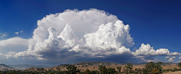 Abbreviation for cumulonimbus, Cumulonimbus cloud, characterized
by strong vertical development in the form of mountains or huge tower stopped at
least partially by a smooth, flat, often fibrous anvil. Also known colloquially
as a "thunderhead."
CC
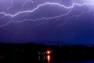 cloud-to-cloud lightning flash: Lightning discharges may occur between
areas of cloud without contacting the ground. When it occurs between two separate
clouds it is known as inter-cloud lightning, and when it occurs between areas of
differing electric potential within a single cloud it is known as intra-cloud lightning.
Intra-cloud lightning is the most frequently occurring type.
CC
 “Cirrocumulus”. A principal cloud type (cloud genus), appearing
as a thin, white patch of cloud without shadows, composed of very small elements
in the form of grains, ripples, etc.
CG
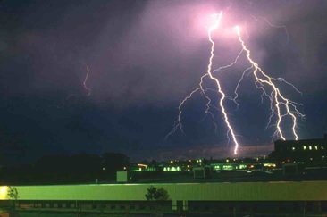 “cloud-to-ground lightning” A cloud-to-ground lightning strike starts as a channel
of negative charges makes its path towards the ground. This occurrence is known
as a stepped leader. The stepped leader continues towards the ground in a series
of steps that are each about 50 to 100 metres in length. This stepped leader can
branch out in many directions.
Clear Slot
A local region of clearing skies or reduced cloud cover, indicating an intrusion
of drier air; often seen as a bright area with higher cloud bases on the west or
southwest side of a wall cloud . A clear slot is believed to be a visual indication
of a rear flank downdraft.
Climate
The historical record and description of average daily and in seasonal weather events
that help describe a region. Statistics are generally drawn over several decades.
The word is derived from the Greek klima, meaning inclination, and reflects the
importance early scholars attributed to the sun's influence.
Closed Low
A low pressure area with a distinct centre of cyclonic circulation which can be completely
encircled by one or more isobars or height contour lines. The term usually is used
to distinguish a low pressure area aloft from a low-pressure trough . Closed lows
aloft typically are partially or completely detached from the main westerly current,
and thus move relatively slowly.
Cloud Burst
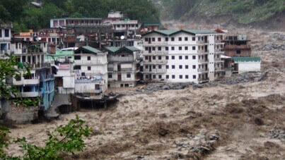 (Also called rain gush, rain gust.) In popular terminology, any sudden and heavy
fall of rain, almost always of the shower type.
An unofficial criterion sometimes used specifies a rate of fall equal to or greater
than 100 mm (3.94 inches) per hour. Clould burst mostly causes flash floods and
can be a threat to urbanisation.
Cloud Cover
The fraction of the sky dome covered by clouds. This fraction is typically expressed
either as tenths (1/10, ..., 10/10) or eighths (1/8, ..., 8/8). Some researchers
refer to this as cloud amount, to clarify the distinction from cloud type, which
is the nature of the cloud cover.
Cloud head (strictly Baroclinic cloud head)
During the early stages of 'explosive cyclogenesis' (q.v.), a very marked area of
dense layered cloud - convex away from the developing depression - can be observed
in IR, VIS and WV imagery, detached from the cloud area associated with the development.
This feature is the result of air rapidly ascending as the intense development gets
underway. Studies have shown that all mid-latitude cyclogenetic events over oceanic
areas giving rise to winds of hurricane force were preceded by such features. However,
care is needed to correctly identify such and true detection is only possible with
animated imagery.
Cloud Streets
 Rows of cumulus or cumulus-type clouds aligned parallel to the low-level flow. Cloud
streets sometimes can be seen from the ground, but are seen best on satellite photographs
Cluster
In ensemble forecasting (q.v.), individual members often show strong grouping around
a few results. Each grouping is referred to as a cluster. The more members making
up a particular cluster, the higher is the confidence in that particular solution.
Comma Cloud
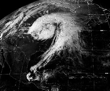 A synoptic scale cloud pattern with a characteristic comma-like shape, often seen
on satellite photographs associated with large and intense low-pressure systems.
Convective temperature
The convective temperature (CT or Tc) is the approximate temperature that air near
the surface must reach for cloud formation without mechanical lift. In such case,
cloud base begins at the convective condensation level (CCL), whilst with mechanical
lifting, condensation begins at the lifted condensation level (LCL). Convective
temperature is important to forecasting thunderstorm development.
Cold-air Funnel
A funnel cloud or (rarely) a small, relatively weak tornado that can develop from
a small shower or thunderstorm when the air aloft is unusually cold (hence the name).
They are much less violent than other types of tornadoes.
Cold anticyclone
(Or cold high; also called cold-core high, cold-core anticyclone.) At a given level
in the atmosphere, any high that is generally characterized by colder air near its
center than around its periphery; the opposite of a warm high.
Cold pool
A region of relatively cold air, represented on a weather map analysis as a relative
minimum in temperature surrounded by closed isotherms. Cold pools aloft represent
regions of relatively low stability, while surface-based cold pools are regions
of relatively stable air.
Cold-Front wave
A common form of secondary depression that forms on a trailing cold front. More than
one such depression may arise, producing a family of depressions in various stages
of development, generally with each successive member forming closer to the Equator.Cold-front
wave Two depressions are developing on the cold front that trails behind the primary
depression. Both may be expected to deepen as they move eastwards.
Condensation
The process by which water vapour undergoes a change in state from a gas to a liquid.
It is the opposite physical process of evaporation.
Condensation nuclei
A particle upon which condensation of water vapour occurs. It may be either in a
solid or liquid state.
Conduction
(Or cold high; also called cold-core high, cold-core anticyclone.) At a given level
in the atmosphere, any high that is generally characterized by colder air near its
center than around its periphery; the opposite of a warm high.
Confluent
A rate at which wind flow comes together along an axis oriented normal to the flow
in question. The opposite of diffluence.
Contours
Generally, an outline or configuration of a body or surface.
Often, the term is used for one of a set of lines (contour lines) drawn to represent
the configuration of a surface; this is the case in meteorology, where a contour
usually refers to a contour line of constant height on a constant-pressure surface.
Sometimes, the term is more loosely used in the general sense of an isopleth.
Contrail
 Acronym for CONdensation TRAIL. A cloud-like streamer or trail often
seen behind aircraft flying in clear, cold, humid air. A vapour trail is created
when the water vapor from the engine exhaust gases are added to the atmosphere.
Convection
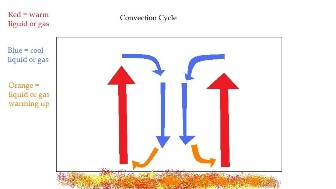 (Or cold high; also called cold-core high, cold-core anticyclone.) At a given level
in the atmosphere, any high that is generally characterized by colder air near its
center than around its periphery; the opposite of a warm high.
Convective condensation level
On a thermodynamic diagram, the point of intersection of a sounding curve (representing
the vertical distribution of temperature in an atmospheric column) with the saturation
mixing ratio line corresponding to the average mixing ratio in the surface layer
(i.e., approximately the lowest 1500 ft).
Convective precipitation
Precipitation particles forming in the active updraft of a cumulonimbus cloud, growing
primarily by the collection of cloud droplets (i.e., by coalescence and/or riming)
and falling out not far from their originating updraft.
Convergence
A contraction of a vector field; the opposite of divergence. Convergence in a horizontal
wind field indicates that more air is entering a given area than is leaving at that
level. To compensate for the resulting "excess," vertical motion may result: upward
forcing if convergence is at low levels, or downward forcing (subsidence) if convergence
is at high levels. Upward forcing from low-level convergence increases the potential
for thunderstorm development (when other factors, such as instability, are favorable).
Compare with confluence.
Convergence zone
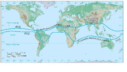 A convergence zone is a region in the atmosphere where two prevailing flows meet
and interact, usually resulting in distinctive weather conditions.
An example of a convergence zone is the Intertropical Convergence Zone (ITCZ), a
low pressure area which girdles the Earth at the Equator. Another example is the
South Pacific convergence zone that extends from the western Pacific Ocean toward
French Polynesia.
Conveyor
In synoptic systems (e.g. a developing depression) airflow is not uniformly horizontal,
and the system velocity (i.e. the speed of translation of the Low) must also be
allowed for. High-velocity air aloft overtakes the synoptic feature, whilst lower
down, the system often moves faster in a given direction than the low level airflow.
To cope with all this, the concept of 'conveyor belts' was adapted for use in synoptic
and mesoscale meteorology as a means of explaining the movement of heat, moisture
and momentum around such systems. For example, in a developing/mobile depression,
a warm conveyor belt (WCB) is assumed to rise from low levels in the warm sector
just ahead of the surface cold front, to middle and upper altitudes over and well
forward of the surface warm front. A compensating cold conveyor belt (CCB), descends
from medium/upper levels well ahead of the surface warm front underneath the WCB
then tucks around the backside of the low merging with the boundary layer flow.
Coriolis effect
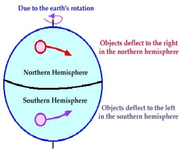 A force per unit mass that arises solely from the earth's in rotation, acting as
a deflecting force. It is dependent on the latitude and the speed of the moving
air mass. In the Northern Hemisphere, air is deflected to the right of its path,
while in the Southern Hemisphere, air is deflected to the left of its path. It is
greatest at the poles, North and South, and almost nonexistent at the equator.
Coriolis parameter
Twice the component of the earth's angular velocity about the local vertical, 2Ω
sinφ, where Ω is the angular speed of the earth and φ is the latitude.
Since the earth is in rigid rotation, the Coriolis parameter is equal to the component
of the earth's vorticity about the local vertical. If the Coriolis parameter is
denoted by f and the speed of a horizontally moving fluid parcel by V, then fV is
the magnitude of the horizontal Coriolis force per unit mass on the parcel.
CS
 “Cirrostratus”. A cirriform cloud that develops from cirrus spreading
out into a thin layer, creating a flat sheet like appearance. It can give the sky
a slightly milky or veiled look. When viewed from the surface of the earth, these
ice crystals can create a halo effect around the sun or moon. This cloud is a good
precursor of precipitation, indicating it may occur within 12 to 24 hours.
A layer of high clouds composed of ice crystals. Cirrostratus are usually very thin
and appear as a white fibrous cloud layer. The layer may be so thin that it may
only be detected by the presence of a halo around the Sun.
CU
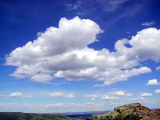 “Cumulus”. Detached clouds, generally dense and with sharp outlines,
showing vertical development in the form of domes, mounds, or towers. Tops normally
are rounded while bases are more horizontal. . Widely known as "fair weather clouds,"
cumulus clouds are one of the three major cloud types that comprise the ten main
groups or genera. Cumulus (a heap, pile, or mound) or convective clouds are defined
as many individual clouds detached and separated by clear skies. The clouds are
dense, developing vertically into domes or towers that resemble cauliflower. The
sunlit upper portion is brilliant white, and the bases are dark and gray. The outlines
of the clouds are sharp when they consist of water droplets and fuzzier or diffuse
when they consist of ice crystals. Besides the genera cumulus clouds, there are
four other genera that are hybrids of cumulus clouds and differ from the most generic
kind of cumulus cloud: cirrocumulus, altocumulus, stratocumulus, and cumulonimbus.
In addition to the more general cumulus formation, when cumulus clouds have only
slight vertical ascent and are usually confined to the lowest 2 kilometers of the
atmosphere they are referred to as cumulus humilis; when cumulus clouds reach moderate
vertical extent (generally between 2 to 6 kilometres above the ground) and exhibit
small protuberances they are termed cumulus mediocris; finally, when cumulus clouds
extend high up into the atmosphere (generally 6 kilometres or more above the ground)
and their bulging parts resemble cauliflower they are called cumulus congestus.
Cumuliform Anvil
A thunderstorm anvil with visual characteristics resembling cumulus-type clouds (rather
than the more typical fibrous appearance associated with cirrus ). A cumuliform
anvil arises from rapid spreading of a thunderstorm updraft , and thus implies a
very strong updraft. See anvil rollover , knuckles , mushroom.
Cut-off time
NWP models that are used in operational meteorology must have a nominal time at which
the 'gates are closed' to new data, and the forecast computation cycle is started.
For models used for primary forecast guidance at short lead times, only a couple
of hours at most is allowed after the nominal data time. So for example, the cut-off
for 12UTC data might be around 1345UTC. For global models, i.e. those used for international
aviation, a slightly longer time is allowed, but usually no more than 3.5hrs after
data time. However, some centres (e.g. ECMWF) with less demand for immediate products
allow over 9 hours or more of data to be assimilated.
Cyclic Storm
A thunderstorm that undergoes cycles of intensification and weakening (pulses) while
maintaining its individuality. Cyclic supercells are capable of producing multiple
tornadoes (i.e., a tornado family ) and/or several bursts of severe weather.
A storm which undergoes only one cycle (pulse), and then dissipates, is known as
a pulse storm .
Cyclogenesis
The process that creates a new low pressure system or cyclone, or intensifies a pre-existing
one. It is also the first appearance of a trough.
Cyclones
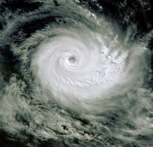 An area of closed pressure circulation with rotating and converging winds, the centre
of which is a relative pressure minimum. The circulation is counter clockwise in
the Northern Hemisphere and clockwise in the Southern Hemisphere. Also called a
low pressure system and the term used for a tropical cyclone in the Indian Ocean.
Other phenomena with cyclonic flow may be referred to by this term, such as dust
devils, tornadoes, and tropical and extra tropical systems. The opposite of an anticyclone
or a high pressure system.
Cyclonic Circulation (or Cyclonic Rotation)
Circulation (or rotation) which is in the same sense as the Earth's rotation, i.e.,
counter clockwise (in the Northern Hemisphere) as would be seen from above. Nearly
all mesocyclones and strong or violent tornadoes exhibit cyclonic rotation, but
some smaller vortices, such as gustnadoes , occasionally rotate anti-cyclonically
(clockwise). Compare with anti-cyclonic rotation
Cyclonic trough disruption
The southern (northern in the southern hemisphere) portion of a trough advances,
perhaps developing a cut-off circulation, and slowly warming out, whilst the opposite
(residual) portion of the trough becomes quasi-stationary, maintaining a cyclonic
pattern at the surface.
DALR
“Dry Adiabatic Lapse Rate”. Rate of change of temperature with height
for a parcel that undergoes an isentropic compression or expansion with no water
substance involved. The numerical value is 9.8° C per kilometre.
dam
Dekametres (i.e. 10's of metres) - often used on upper air charts:
thus a 500 hPa height quoted as 540 dam is equivalent to 5400 metres.
Daughter cell
As the precipitation downdraught associated with a marked Cumulonimbus event meets
the ground, it will spread out in all directions. Where this cold outflow current
meets the low level inflow (relative to the cloud motion) 'head-on', then this is
a point of maximum convergence, leading to forced lifting of the air at that point,
and provided the air is unstable enough, and convection is not otherwise inhibited
(e.g. wide scale descent), then a new convective cloud event will be initiated -
a daughter cell.
DBZ
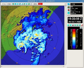 Non-dimensional "unit" of radar reflectivity which represents a logarithmic power
ratio (in decibels, or dB) with respect to radar reflectivity factor, Z.
The value of Z is a function of the amount of radar beam energy that is backscattered
by a target and detected as a signal (or echo). Higher values of Z (and dBZ) thus
indicate more energy being backscattered by a target. The amount of backscattered
energy generally is related to precipitation intensity, such that higher values
of dBZ that are detected from precipitation areas generally indicate higher precipitation
rates. However, other factors can affect reflectivity, such as width of the radar
beam, precipitation type, drop size, or the presence of ground clutter or AP . WSR-88D
radars can detect reflectivities as low as -32 dBZ near the radar site, but significant
(measurable) precipitation generally is indicated by reflectivities of around 15
dBZ or more. Values of 50 dBZ or more normally are associated with heavy thunderstorms,
perhaps with hail, but as with most other quantities, there are no reliable threshold
values to confirm the presence of hail or severe weather in a given situation.
Debris Cloud
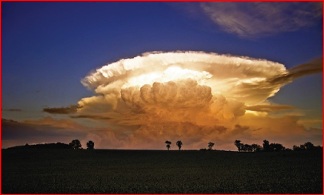 A rotating "cloud" of dust or debris, near or on the ground, often appearing beneath
a condensation funnel and surrounding the base of a tornado.
This term is similar to dust whirl , although the latter typically refers to a circulation
which contains dust but not necessarily any debris. A dust plume , on the other
hand, does not rotate. Note that a debris cloud appearing beneath a thunderstorm
will confirm the presence of a tornado, even in the absence of a condensation funnel.
Decoupling
A process where one layer of the atmosphere stops interacting with an adjacent layer.
An example is a stratocumulus-topped turbulent boundary layer during the night,
where infrared irradiative cooling of cloud top causes cold "thermals" to sink toward
the ground, causing strong turbulent coupling between the cloud and sub-cloud layers.
During the day, these two layers can become decoupled as the combination of solar
heating and infrared cooling in the cloud layer combine to make the cloud layer
warmer than the sub-cloud layer, with a weak stable layer in between that reduces
or prevents turbulent coupling of the two layers. These turbulently decoupled layers
might still interact (i.e., be slightly coupled) in other ways, such as via radiation
or drizzle fallout.
Delta T
A simple representation of the mean lapse rate within a layer of the atmosphere,
obtained by calculating the difference between observed temperatures at the bottom
and top of the layer. Delta Ts often are computed operationally over the layer between
pressure levels of 700 mb and 500 mb, in order to evaluate the amount of instability
in mid-levels of the atmosphere. Generally, values greater than about 18 indicate
sufficient instability for severe thunderstorm development.
DENEB
(used in METAR reports) - fog dispersal operations are in progress (probably obsolete
now so included for historical purposes).
Derecho
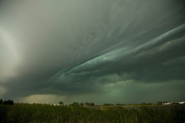 A derecho ( "straight", pronounced ), is a widespread and long-lived, violent convectively
induced straight-line windstorm that is associated with a fast-moving band of severe
thunderstorms in the form of a squall line usually taking the form of a bow echo.
Derechos blow in the direction of movement of their associated storms, similar to
a gust front, except that the wind is sustained and generally increases in strength
behind the "gust" front. A warm weather phenomenon, derechos occur mostly in summer,
especially June and July in the Northern Hemisphere. They can occur at any time
of the year and occur as frequently at night as in the daylight hours.
Deterministic forecast
A forecast that says rain will occur at such-and-such a place within a given time
band, i.e. a 'yes/no' forecast, is an example of deterministic forecasting.
Dew Point
It is measure of atmospheric moisture. It is the temperature to which air must be
cooled in order to reach saturation (assuming air pressure and moisture content
are constant).
Dew-point depression (DPD)
The dew point depression (T-Td) is the difference between the temperature and dew
point temperature at a certain height in the atmosphere. The smaller the difference,
the more moisture there is, and the higher the relative humidity. In the lower troposphere,
more moisture (small dew point depression) results in lower cloud bases and is also
important to severe thunderstorms.[clarification needed] Conversely, instability
is increased when there is a mid-level dry layer (large dew point depression) known
as a "dry punch", which is favourable for convection if the lower layer is buoyant.
Differential Motion
Cloud motion that appears to differ relative to other nearby cloud elements, e.g.
clouds moving from left to right relative to other clouds in the foreground or background.
Cloud rotation is one example of differential motion, but not all differential motion
indicates rotation. For example, horizontal wind shear along a gust front may result
in differential cloud motion without the presence of rotation.
Diffuse Sky Radiation
The radiation component that strikes a point from the sky, excluding circumsolar
radiation. In the absence of atmosphere, there should be almost no diffuse sky radiation.
High values are produced by an unclear atmosphere or reflections from clouds
Diffluence
(or Diffluent) - A pattern of wind flow in which air moves outward (in a "fan-out"
pattern) away from a central axis that is oriented parallel to the general direction
of the flow. It is the opposite of confluence. Difluence in an upper level wind
field is considered a favourable condition for severe thunderstorm development (if
other parameters are also favourable). But difluence is not the same as divergence
. In a difluent flow, winds normally decelerate as they move through the region
of difluence, resulting in speed convergence which offsets the apparent diverging
effect of the difluent flow.
Direct solar radiation
Solar radiation that has not been scattered or absorbed. In practice, solar radiation
that has been scattered through only a few degrees, characteristic of the diffraction
peak of the scattering function, is unavoidably included in the operational measurement
of direct solar radiation by a pyrheliometer
Directional Shear
The component of wind shear which is due to a change in wind direction with height,
e.g., south-easterly winds at the surface and south-westerly winds aloft. A veering
wind with height in the lower part of the atmosphere is a type of directional shear
often considered important for tornado development.
Discontinuity
Comparatively large contrast in meteorological elements over a relatively small distance
or period of time. In oceanography, it is the abrupt change or jump of a variable
at a line or surface.
Diurnal cycle
This is another name for daily cycle. For a given location on the Earth, daily cycles
in meteorological variables such as temperature, relative humidity, precipitation,
wind speed, and direction are all due to the Earth's rotation. These daily cycles
follow the insolation cycle. They are most pronounced at mid latitudes and in the
tropics and least pronounced (or missing) near the poles at the time of the solstices.
Divergence
Wind movement that results in a horizontal net outflow of air from a particular region.
Divergence at lower levels is associated with a downward movement of air from aloft.
Contrast with convergence.
DM
(obsolete abbreviation for dekametre - dekametres (i.e. 10's of metres) - often used
on upper air charts: thus a 500 hPa height quoted as 540 dam is equivalent to 5400
metres. )
Doppler Radar
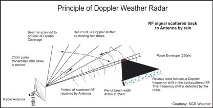 A Doppler radar is specialized radar that makes use of the Doppler effect to produce
velocity data about objects at a distance. It does this by beaming a microwave signal
towards a desired target and listening for its reflection, then analyzing how the
frequency of the returned signal has been altered by the object's motion. This variation
gives direct and highly accurate measurements of the component of a target's velocity
relative to the radar. Doppler radars are used in aviation, sounding satellites,
meteorology, police speed guns, radiology, and ballistic radar (surface to air missile).
Downburst
A strong downdraft resulting in an outward burst of damaging winds on or near the
ground. Downburst winds can produce damage similar to a strong tornado . Although
usually associated with thunderstorms, downbursts can occur with showers too weak
to produce thunder.
Downdraft
A small-scale column of air that rapidly sinks toward the ground, usually accompanied
by precipitation as in a shower or thunderstorm. A downburst is the result of a
strong downdraft.
Downward penetration of Snow
Falling snow modifies the temperature structure of the atmospheric boundary layer
as both melting & evaporation takes place. Even if snow does not initially penetrate
to the surface (after having fallen out of the parent cloud), if the Wet Bulb Freezing
Level (q.v.) is low enough, the intensity of the precipitation is more than just
'light' and the mean wind strength in the melting layer is not too strong, then
the snow level can descend considerably below initial conditions. The depth of this
'downward penetration of snow' as it is called, increases as the intensity of rain
increases, and/or the wind speed decreases. It will be immediately apparent that
the prospect for error in snow forecasting due to these variables in 'marginal'
situations will be large
DPD
“Dew-point depression” The dew point depression (T-Td) is the difference between
the temperature and dew point temperature at a certain height in the atmosphere.
The smaller the difference, the more moisture there is, and the higher the relative
humidity. In the lower troposphere, more moisture (small dew point depression) results
in lower cloud bases and is also important to severe thunderstorms.[clarification
needed] Conversely, instability is increased when there is a mid-level dry layer
(large dew point depression) known as a "dry punch", which is favourable for convection
if the lower layer is buoyant.
DR
Used in METAR reports - low drifting (snow, sand etc.), not appreciably affecting
the visibility, e.g. DRSN.
Drought
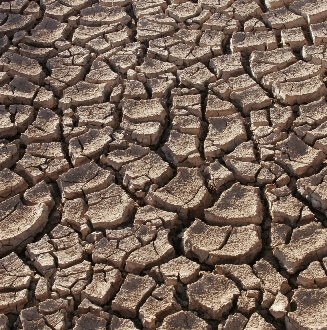 A period of abnormally dry weather sufficiently long enough to cause a serious hydrological
imbalance.
Drought is a relative term; therefore any discussion in terms of precipitation deficit
must refer to the particular precipitation-related activity that is under discussion.
For example, there may be a shortage of precipitation during the growing season
resulting in crop damage (agricultural drought), or during the winter runoff and
percolation season affecting water supplies (hydrological drought).
Droughts - types of
Droughts as defined above are essentially meteorological; in other words, Meteorological
drought is the amount of dryness and the duration of the dry period. Atmospheric
conditions that result in deficiencies of precipitation change from area to area.
Agricultural drought mainly effects food production and farming. Agricultural drought
and precipitation shortages bring soil water deficits, reduced ground water or reservoir
levels, and so on. Deficient topsoil moisture at planting may stop germination,
leading to low plant populations. Hydrological drought is associated with the effects
of periods of precipitation shortages on water supply. Water in hydrologic storage
systems such as reservoirs and rivers are often used for multiple purposes such
as flood control, irrigation, recreation, navigation, hydropower, and wildlife habitat.
Competition for water in these storage systems escalates during drought and conflicts
between water users increase significantly. Socioeconomic drought occurs when the
demand for an economic good exceeds supply as a result of a weather-related shortfall
in water supply. The supply of many economic goods, such as water, forage, food
grains, fish, and hydroelectric power, depends on weather. Due to variability of
climate, water supply is sufficient in some years but not satisfactory to meet human
and environmental needs in other years. The demand for economic goods is increasing
as a result of increasing population. Supply may also increase because of improved
production efficiency and technology.
Dry Microburst
A microburst with little or no precipitation reaching the ground; most common in
semi-arid regions. They may or may not produce lightning. Dry microbursts may develop
in an otherwise fair-weather pattern; visible signs may include a cumulus cloud
or small Cb with a high base and high-level virga , or perhaps only an orphan anvil
from a dying rain shower. At the ground, the only visible sign might be a dust plume
or a ring of blowing dust beneath a local area of virga. Compare with wet microburst
.
Dry spell
A period of precipitation below a specified amount.
The specific period and amount of precipitation vary depending on the particular
activity under discussion.
DS
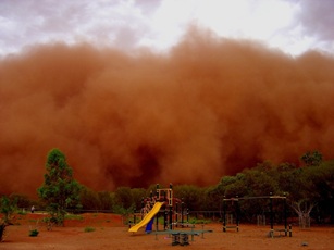 “Duststorm” (used in METAR/TAF reports etc.); A severe weather condition
characterized by strong winds and dust-filled air over a large area. Visibility
is reduced to between 200 and 100 meters. It is reported as "DS" in an observation
and on the METAR. D-VALUE The deviation of actual altitude along a constant pressure
surface from the standard atmosphere altitude of that surface. visibility generally
< 1km due to dust raised by strong winds over a large area.
DU
Dust ( Small particles of earth or other matter suspended in the air. It is reported
as "DU" in an observation and for wide spread dust on the METAR.) Visibility is
5000 m or less.
Dust Devil
A small atmospheric vortex not associated with a thunderstorm, which is made visible
by a rotating cloud of dust or debris (dust whirl). Dust devils form in response
to surface heating during fair, hot weather; they are most frequent in arid or semi-arid
regions.
Dust Plume
A non-rotating "cloud" of dust raised by straight-line winds. Often seen in a microburst
or behind a gust front.
If rotation is observed, then the term dust whirl or debris cloud should be used.
Dynamic precipitation
Dynamic precipitation or Stratiform occurs as a consequence of slow ascent of air
in synoptic systems (on the order of cm/s), such as over surface cold fronts, and
over and ahead of warm fronts.
DZ
Drizzle (Slowly falling precipitation in the form of tiny water
droplets with diameters less than 0.02 inches or 0.5 millimetres. It falls from
stratus clouds and is often associated with low visibility and fog. It is reported
as "DZ" in an observation and on the METAR).
Eclipse (of a geostationary satellite)
The earth's equator (and therefore a geostationary satellites orbit) is inclined
to the orbit of the earth around the sun. This inclination allows sunlight to power
the satellite on-board systems for most of the year. However, there is a period
of about 3 weeks either side of the vernal and autumnal equinoxes when a satellite
will be in the earth's shadow for about 70 minutes each day (around local midnight).
Because most of these platforms do not carry sufficient battery power to tide them
over this gap, no imagery is generated and thus a local-midnight image is missing.
ECMWF
The European Centre for Medium-Range Weather Forecasts (ECMWF) is an independent
intergovernmental organisation supported by 19 European Member States and 15 Co-operating
States. At its headquarters in Reading, England, one of the largest supercomputer
complexes in Europe is linked by high-speed telecommunication lines to the computer
systems of the national weather services of its supporting states. The Centre's
computer system contains the world's largest archive of numerical weather prediction
data.
ELR
“Environmental Lapse Rate” The rate of decrease of temperature with elevation, -∂T/∂z,
or occasionally ∂T/∂p, where p is pressure. The concept may be applied to other
atmospheric variables (e.g., lapse rate of density) if these are specified. The
environmental lapse rate is determined by the distribution of temperature in the
vertical at a given time and place and should be carefully distinguished from the
process lapse rate, which applies to an individual air parcel.
Elevated Convection
Convection occurring within an elevated layer, i.e., a layer in which the lowest
portion is based above the earth's surface. Elevated convection often occurs when
air near the ground is relatively cool and stable, e.g., during periods of isentropic
lift , when an unstable layer of air is present aloft. In cases of elevated convection,
stability indices based on near-surface measurements (such as the lifted index )
typically will underestimate the amount of instability present. Severe weather is
possible from elevated convection, but is less likely than it is with surface-based
convection.
Energy Helicity Index (or EHI)
An index that incorporates vertical shear and instability, designed for the purpose
of forecasting super-cell thunderstorms. It is related directly to storm-relative
helicity in the lowest 2 km (SRH, in m2/s2) and CAPE (in j/kg) as follows:
EHI = (CAPE x SRH)/160,000. Thus, higher values indicate unstable conditions and/or
strong vertical shear. Since both parameters are important for severe weather development,
higher values generally indicate a greater potential for severe weather. Values
of 1 or more are said to indicate a heightened threat of tornadoes; values of 5
or more are rarely observed, and are said to indicate potential for violent tornadoes.
However, there are no magic numbers or critical threshold values to confirm or predict
the occurrence of tornadoes of a particular intensity.
Ensemble
A collection of NWP runs (typically in excess of 15, many having 50 or more) from
the same start time (t=0) and using the same model physics, but each run (or 'member')
having a slightly perturbed (altered) set of initial conditions from the 'control'
run (q.v). The alterations are constrained within limits which are calculated in
various ways - one example being that of performing a separate short-range model
run and identifying the errors that would grow most over a 48 hr period. These errors
are then applied in varying amounts to the initial conditions before performing
the operational ensemble run. Another technique is to use (known) errors from a
previous run and apply these in small amounts to the initial conditions of the new
run
Ensemble mean
The average of a predicted variable or field over an ensemble of forecasts.
In taking the mean, one filters those aspects of the forecasts that are not predictable.
Environmental Lapse Rate
The rate of decrease of temperature with elevation, -∂T/∂z, or occasionally ∂T/∂p,
where p is pressure.
The concept may be applied to other atmospheric variables (e.g., lapse rate of density)
if these are specified. The environmental lapse rate is determined by the distribution
of temperature in the vertical at a given time and place and should be carefully
distinguished from the process lapse rate, which applies to an individual air parcel.
Eta Model
One of the operational numerical forecast models run at NCEP . The Eta is run twice
daily, with forecast output out to 48 hours.
Evaporation
(Also called vaporization.) The physical process by which a liquid or solid is transformed
to the gaseous state; the opposite of condensation.
Evaporation is usually restricted in use to the change of water from liquid to gas,
while sublimation is used for the change from solid to gas. According to the kinetic
theory of gases, evaporation occurs when liquid molecules escape into the vapour
phase as a result of the chance acquisition of above-average, outward-directed,
translational velocities at a time when they happen to lie within about one mean
free path below the effective liquid surface. It is conventionally stated that evaporation
into a gas ceases when the gas reaches saturation. In reality, net evaporation does
cease, but only because the numbers of molecules escaping from and returning to
the liquid are equal, that is, evaporation is counteracted by condensation. Because
the molecules that escape the condensed phase have above-average energies, those
left behind have below-average energies, which is manifested by a decrease in temperature
of the condensed phase
Extraterrestrial radiation
Abbreviated ETR, also known as "top-of-atmosphere" (TOA) irradiance, is the amount
of global horizontal radiation that a location on Earth would receive if there was
no atmosphere or clouds (i.e., in outer space). This number is used as the reference
amount against which actual solar energy measurements are compared.
FC
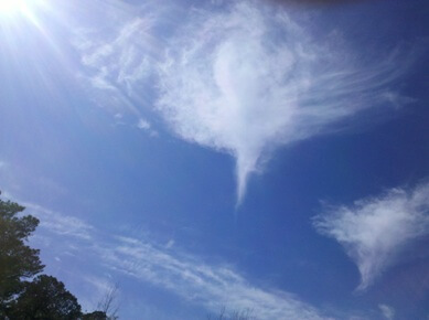 “Funnel Cloud” - (in METAR/TAF, this includes tornado/waterspout,
so differs from the classical distinction between a funnel cloud not touching down,
and one that does . A violent, rotating column of air visibly extending from the
base of a towering cumulus or cumulonimbus toward the ground, but not in contact
with it. It is reported as "FC" in an observation and on the METAR. ).
FEW
The amount of sky cover for a cloud layer between 1/8th and 2/8ths, based on the
summation layer amount for that layer, used in Aviation/METAR reports etc.
FG
(abbr) Fog (vis < 1000m, except when qualified by MI, BC, PR, VC); used in METAR/TAF
reports etc.
FL
(abbr) Flight level (e.g. FL240 ... 24000ft amsl/standard atmosphere); used in aviation
reports, forecasts etc.
Fog
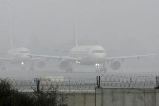 A visible aggregate of minute water droplets suspended in the atmosphere at or near
the surface of the earth, reducing horizontal visibility to less than 200 meters.
It is created when the temperature and the dew point of the air have become the
same, or nearly the same and sufficient condensation nuclei are present. It is reported
as "FG" in an observation and on the METAR.
Fog Point
( or fog-point temperature) The air temperature at which fog is expected/does form.
Its calculation (before an event) is usually based on empirical work which employs
either the surface air temperature/dew point at some time earlier in the day, or
by construction on a thermodynamic diagram. The fog point is lower than the air-mass
dew point, because as air cools through the evening and night, moisture is condensed
out on contact with the chilled land surface, and this lowers the dew point from
afternoon values.
Fractus clouds
 Fractus clouds (scuds) are small, ragged cloud fragments that are usually found under
an ambient cloud base. They form or have broken off from a larger cloud, and are
generally sheared by strong winds, giving them a jagged, shredded appearance. Fractus
have irregular patterns, appearing much like torn pieces of cotton candy. They change
constantly, often forming and dissipating rapidly. They do not have clearly defined
bases. Sometimes they are persistent and form very near the surface. Common kinds
include scud and cloud tags.
Freezing fog
Used to describe the phenomena when fog is present and the air temperature is below
0°C. It is reported as "FZFG" in an observation and on the METAR.
Freezing level
Commonly, and in aviation terminology, the lowest altitude in the atmosphere, over
a given location, at which the air temperature is 0°C;
the height of the 0°C constant-temperature surface.
This simple concept may become slightly complicated by the existence of one or more
"above- freezing layers" formed by temperature inversions at altitudes higher than
the above-defined freezing level. In cloud physics terminology, this is more accurately
termed the melting level, for melting of ice always occurs very near 0°C, but liquid
cloud drops may remain super cooled to much colder temperatures.
Front
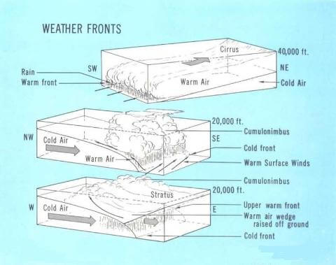 In meteorology, generally, the interface or transition zone between two air masses
of different density.
Since the temperature distribution is the most important regulator of atmospheric
density, a front almost invariably separates air masses of different temperature.
Along with the basic density criterion and the common temperature criterion, many
other features may distinguish a front, such as a pressure trough, a change in wind
direction, a moisture discontinuity, and certain characteristic cloud and precipitation
forms. The term front is used ambiguously for 1) frontal zone, the three- dimensional
zone or layer of large horizontal density gradient, bounded by 2) frontal surfaces
across which the horizontal density gradient is discontinuous (frontal surface usually
refers specifically to the warmer side of the frontal zone); and 3) surface front,
the line of intersection of a frontal surface or frontal zone with the earth's surface
or, less frequently, with a specified constant-pressure surface. Types of front
include polar front, arctic front, cold front, warm front, and occluded front.
Frontal fracture
During rapid cyclogenesis events, a weakness appears along the portion of the cold-front
nearest to the depression centre, thought to be due to a combination of subsidence
in this region, plus differential thermal advection, as, unlike in the 'Norwegian'
model, cold air is not adverted so quickly eastwards to maintain the baroclinicity
in this region.
Frontogenetic
Frontogenesis is a meteorological process of tightening of horizontal temperature
gradients to produce fronts. In the end, two types of fronts form: cold fronts and
warm fronts.
Frontolysis
The destruction or dying of a front where the transition zone is losing its contrasting
properties. The opposite of frontogenesis.
Frost
 The fuzzy layer of ice crystals on a cold object, such as a window or bridge, that
forms by direct deposition of water vapor to solid ice.
The condition that exists when the temperature of the earth's surface and earthbound
objects fall below freezing.
Depending upon the actual values of ambient-air temperature, dew point, and the
temperature attained by surface objects, frost may occur in a variety of forms.
These include a general freeze, hoarfrost (or white frost), and dry freeze (or black
frost). If a frost period is sufficiently severe to end the growing season (or delay
its beginning), it is commonly referred to as a killing frost.
Frost Point
(strictly frost-point temperature) (Or dew point temperature.) The temperature to
which a given air parcel must be cooled at constant pressure and constant water
vapour content in order for saturation to occur.
When this temperature is below 0°C, it is sometimes called the frost point. The
dew point may alternatively be defined as the temperature at which the saturation
vapour pressure of the parcel is equal to the actual vapour pressure of the contained
water vapour. Isobaric heating or cooling of an air parcel does not alter the value
of that parcel's dew point, as long as no vapour is added or removed. Therefore,
the dew point is a conservative property of air with respect to such processes.
However, the dew point is non-conservative with respect to vertical adiabatic motions
of air in the atmosphere. The dew point of ascending moist air decreases at a rate
only about one-fifth as great as the dry-adiabatic lapse rate. The dew point can
be measured directly by several kinds of dew point hygrometers or it can be deduced
indirectly from psychrometers or devices that measure the water vapour density or
mixing ratio.
Fujita Scale (or F Scale)
A scale of wind damage intensity in which wind speeds are inferred from an analysis
of wind damage:
F0 (weak): 40- 72 mph, light damage.
F1 (weak): 73-112 mph, moderate damage.
F2 (strong): 113-157 mph, considerable damage.
F3 (strong): 158-206 mph, severe damage.
F4 (violent): 207-260 mph, devastating damage.
F5 (violent): 261-318 mph, (rare) incredible damage.
All tornadoes , and most other severe local windstorms, are assigned a single number
from this scale according to the most intense damage caused by the storm.
FZ
(abbr) Freezing; A descriptor, FZ, used to describe drizzle and/or rain that freezes
on contact with the ground or exposed objects, and used also to describe fog that
is composed of minute ice crystals.
Gale
In general and in popular use, an unusually strong wind.
In storm-warning terminology, a wind of 28–47 knots.
GC
[ground-to-cloud lightning flash] Ground-to-cloud lightning is an artificially initiated,
or triggered, category of CG flashes. Triggered lightning originates from tall,
positively-charged structures on the ground, such as towers on mountains that have
been inductively charged by the negative cloud layer above.
Geopotential
The work required to raise a unit mass from mean sea level to a specified height.
Geopotential often replaces the geometric height in the hydrostatic equation. Geopotential
variation with respect to height is only dependent on temperature.
Geostrophic wind
A steady horizontal motion of air along straight, parallel isobars or contours in
an unchanging pressure or contour field. It is assumed that there is no friction,
that the flow is straight with no curvature and there is no divergence or convergence
with no vertical acceleration.
GFS - Global Forecast System
The Global Forecast System (GFS) is a global numerical weather prediction computer
model run by NOAA. This mathematical model is run four times a day and produces
forecasts up to 16 days in advance, but with decreasing spatial and temporal resolution
over time. It is widely accepted that beyond 7 days the forecast is very general
and not very accurate, and most nongovernmental agencies rarely use any of the model's
results beyond 10 days (especially because there is no other 16-day model with which
to compare).
GR
.jpg) Hail Precipitation that originates in convective clouds, such as cumulonimbus, in
the form of balls or irregular pieces of ice, which comes in different shapes and
sizes. Hail is considered to have a diameter of 5 millimeter or more; smaller bits
of ice are classified as ice pellets, snow pellets, or graupel. Individual lumps
are called hailstones. It is reported as "GR" in an observation and on the METAR.
Small hail and/or snow pellets is reported as "GS" in an observation and on the
METAR.
Hail Precipitation that originates in convective clouds, such as cumulonimbus, in
the form of balls or irregular pieces of ice, which comes in different shapes and
sizes. Hail is considered to have a diameter of 5 millimeter or more; smaller bits
of ice are classified as ice pellets, snow pellets, or graupel. Individual lumps
are called hailstones. It is reported as "GR" in an observation and on the METAR.
Small hail and/or snow pellets is reported as "GS" in an observation and on the
METAR.
Hail storm is common phenomena in tropical counties and is often very damaging to
the crops.
Gradient wind
A steady horizontal air motion along curved parallel isobars or contours in an unchanging
pressure or contour field, assuming there is no friction and no divergence or convergence.
Ground Clutter
A pattern of radar echoes from fixed ground targets (buildings, hills, etc.) near
the radar. Ground clutter may hide or confuse precipitation echoes near the radar
antenna.
Global Solar Radiation
Solar radiation, direct and diffuse, received from a solid angle of 2π steradians
on a horizontal surface.
GS
(Small hail) Frozen precipitation in the form of white, round or conical opaque grains
of ice. Their diameter ranges from 2 to 5 mm. They are easily crushed and generally
break up after rebounding from a hard surface, unlike hail. Sometimes it is called
small or soft hail. It is reported as "GS" in an observation and on the METAR.
Gust
A sudden, brief increase in the speed of the wind.
It is of a more transient character than a squall and is followed by a lull or slackening
in the wind speed. Generally, winds are least gusty over large water surfaces and
most gusty over rough land and near high buildings. According to weather observing
practice, gusts are reported when the peak wind speed reaches at least 16 knots
and the variation in wind speed between the peaks and lulls is at least 9 knots.
The duration of a gust is usually less than 20 s.
Gust Front
The leading edge of gusty surface winds from thunderstorm downdrafts; sometimes associated
with a shelf cloud or roll cloud.
Gustnado
Gust front tornado. A small tornado, usually weak and short-lived, that occurs along
the gust front of a thunderstorm. Often it is visible only as a debris cloud or
dust whirl near the ground. Gustnadoes are not associated with storm-scale rotation
(i.e. mesocyclones ); they are more likely to be associated visually with a shelf
cloud than with a wall cloud .
Hail
Precipitation in the form of balls or irregular lumps of ice, always produced by
convective clouds, nearly always cumulonimbus.
An individual unit of hail is called a hailstone. By convention, hail has a diameter
of 5 mm or more, while smaller particles of similar origin, formerly called small
hail, may be classed as either ice pellets or snow pellets. Thunderstorms that are
characterized by strong updrafts, large liquid water contents, large cloud-drop
sizes, and great vertical height are favorable to hail formation. The destructive
effects of hailstorms upon plant and animal life, buildings and property, and aircraft
in flight render them a prime object of weather modification studies. In aviation
weather observations, hail is encoded A.
Hail Stage
Part of an obsolete conceptual model of air parcel ascent referring to a portion
of the ascent during which the parcel temperature remains at the freezing point
until all the rain produced previously has frozen.
Hailstone
A single unit of hail, ranging in size from that of a pea to that of a grapefruit
(i.e., from 5 mm to more than 15 cm in diameter).
Hailstones may be spheroidal, conical, or generally irregular in shape. The spheroidal
stones often exhibit a layered internal structure, with layers of ice containing
many air bubbles alternating with layers of relatively clear ice. These probably
correspond to dry growth and wet growth and are called rime and glaze, respectively.
The conical stones fall with their bases downward without much tumbling and are
often smaller and not as layered. Irregular hailstones often have a lobate structure
and are not composed of smaller hailstones frozen together. Hailstones grow by accretion
of supercooled water drops and sometimes also by accretion of minor amounts of small
ice particles. Large hail may contain liquid water and be spongy (an intimate mixture
of ice and water) in some regions; it is usually solid ice with density greater
than 0.8 g cm-3. Small hail may be indistinguishable from large graupel (snow pellets)
except for the convention that hail must be larger than 5 mm in diameter. The density
of small hail can be much less than 0.8 g cm-3 if they are dry; if partly melted
such hailstones become spongy.
Hailstorm
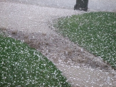 Any storm that produces hailstones that fall to the ground; usually used when the
amount or size of the hail is considered significant.
Helicity
A property of a moving fluid which represents the potential for helical flow to evolve.
Helicity is proportional to the strength of the flow, the amount of vertical wind
shear, and the amount of turning in the flow (i.e. vorticity ).
Atmospheric helicity is computed from the vertical wind profile in the lower part
of the atmosphere (usually from the surface up to 3 km), and is measured relative
to storm motion
Hook (or Hook Echo)
Vorticity caused by a change in wind direction or wind speed with height is termed
horizontal vorticity (the spin is in relation to a horizontal axis). Horizontal
vorticity is most important in the PBL (low-levels of atmosphere). i.e. If the wind
at the surface is southeast at 30 knots and the wind speed at 700 mb is west at
60 knots, there will be a large amount of speed and directional (veering) shear
with height and therefore a large amount of horizontal vorticity.
Horizontal vorticity
Vorticity caused by a change in wind direction or wind speed with height is termed
horizontal vorticity (the spin is in relation to a horizontal axis). Horizontal
vorticity is most important in the PBL (low-levels of atmosphere). i.e. If the wind
at the surface is southeast at 30 knots and the wind speed at 700 mb is west at
60 knots, there will be a large amount of speed and directional (veering) shear
with height and therefore a large amount of horizontal vorticity.
HP Storm or HP Supercell
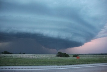 High-Precipitation storm (or High-Precipitation supercell ). A supercell thunderstorm
in which heavy precipitation (often including hail) falls on the trailing side of
the mesocyclone Precipitation often totally envelops the region of rotation, making
visual identification of any embedded tornadoes difficult and very dangerous. Unlike
most classic supercells, the region of rotation in many HP storms develops in the
front-flank region of the storm (i.e., usually in the eastern portion). HP storms
often produce extreme and prolonged downburst events, serious flash flooding, and
very large damaging hail events.
Humidity
Generally, some measure of the water vapour content of air.
The multiplicity of humidity measures is partly due to different methods of measurement
and partly because the conservative measures (mixing ratio, specific humidity) cover
an extremely wide dynamic range, as a result of the rapid variation of saturation
vapour pressure with temperature.
Haze
 Haze: A suspension of fine dust and/or smoke particles in the air. Invisible to the
naked eye, the particles reduce visibility by being sufficiently numerous to give
the air an opalescent appearance. It is reported as "HZ" in an observation and on
the METAR.
IC
Ice crystals (also known as diamond dust); Precipitation in the form of slowly falling,
singular or unbranched ice needles, columns, or plates. They make up cirriform clouds,
frost, and ice fog. Also, they produce optical phenomena such as halos, coronas,
and sun pillars. May be called "diamond dust." It is reported as "IC" in an observation
and on the METAR.
ICE
The solid form of water. It can be found in the atmosphere in the form of ice crystals,
snow, ice pellets, and hail for example.
Ice Day
In climatology, a day on which the maximum air temperature in a thermometer shelter
does not rise above 0°C (32°F), and ice on the surface of water does not thaw.
Ice Fog
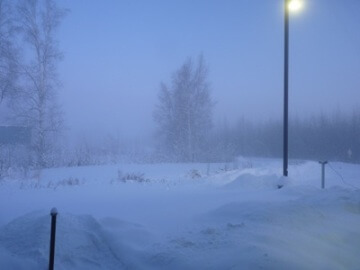 A type of cloud near ground which is made of tiny particles of ice instead of water
droplets. The dew-point temperature in this case must be well below freezing or
else supercooled liquid droplets are likely to form instead. Like fog, it forms
in clear and calm weather conditions. Ice fog is most common at high latitudes where
those extremely cold temperatures and dew-point temperatures are most common.
Insolation
Solar radiation or heating received at the earth's surface. The name is derived from
INcoming SOLar radiATION.
Inversion (of temperature)
A departure from the usual increase or decrease of an atmospheric property with altitude.
It usually refers to an increase in temperature with increasing altitude, which
is a departure from the usual decrease of temperature with height.
IPV
Isentropic Potential Vorticity - the product of the absolute vorticity of an air
parcel, and its static stability, calculated along a constant surface of 'theta'
(potential temperature), hence the 'isentropic'. Anomalies in IPV around the level
of the tropopause (and hence in the region of the driving jet stream) can be related
to developments through the troposphere, leading to cyclogenesis. Because IPV is
a highly conservative property for any sample of air, it is found to be particularly
useful for tracking the path that stratospheric air (high IPV values) will take
as it enters the upper troposphere during rapid cyclogenesis events. -
IR
Infra-red (used in connection with satellite imagery) The long wave, electromagnetic
radiation of radiant heat emitted by all hot objects. On the electromagnetic spectrum,
it can be found between microwave radiation and visible light. Water vapour, ozone,
and carbon dioxide are capable of absorbing or transmitting infrared radiation.
IR Camera
An infrared camera is a non-contact device that detects infrared energy (heat) and
converts it into an electronic signal, which is then processed to produce a thermal
image on a video monitor and perform temperature calculations. Heat sensed by an
infrared camera can be very precisely quantified, or measured, allowing you to not
only monitor thermal performance, but also identify and evaluate the relative severity
of heat-related problems.
ISA
The International Standard Atmosphere (ISA) is an atmospheric model of how the pressure,
temperature, density, and viscosity of the Earth's atmosphere change over a wide
range of altitudes. It has been established to provide a common reference for temperature
and pressure and consists of tables of values at various altitudes, plus some formulas
by which those values were derived.
Isentropic Lift
Lifting of air that is travelling along an upward-sloping isentropic surface. Isentropic
lift often is referred to erroneously as overrunning , but more accurately describes
the physical process by which the lifting occurs. Situations involving isentropic
lift often are characterized by widespread stratiform clouds and precipitation,
but may include elevated convection in the form of embedded thunderstorms.
Isobar
A line of equal or constant pressure; an isopleths of pressure.
In meteorology, it most often refers to a line drawn through all points of equal
atmospheric pressure along a given reference surface, such as a constant-height
surface (notably mean sea level on surface charts), an isentropic surface, the vertical
plane of a synoptic cross section, etc. The pattern of isobars has always been a
main feature of surface-chart analysis. Isobars are usually drawn at intervals of
one millibar or more, depending on the scale needed to identify or illustrate a
specific meteorological pattern.
Isotherm
The line of equal or constant air temperature. If something is isothermal, it is
of equal or constant temperature with respect to either time or space.
Jet-effect wind
A local wind created by acceleration of the airflow through a gap, constriction, or channel in a mountain range or between ranges.
The acceleration can result from a large-scale pressure gradient, or by Venturi acceleration through a constricting passage. Pressure gradients from large-scale processes can occur when a large- scale anticyclone lies on one side of the barrier, as in the case of canyon or Wasatch winds, or when a cold front impinges on a mountain barrier with a gap in it and the cold air mass forces its way through the gap.
Jet Stream
A narrow band of strong winds in the atmosphere that controls the movement of high and low pressure systems and associated fronts. Jet Streams meander from time to time. Wind speeds can reach 200 mph or higher in certain cases. It is usually found at 30,000 to 40,000 feet above the earth's surface. It owes its existence to the large temperature contrast between the polar and equatorial regions. The position and orientation of jet streams vary from day to day. General weather patterns (hot/cold, wet/dry) are related closely to the position, strength and orientation of the jet stream (or jet streams). A jet stream at low levels is known as a low-level jet.
Katabatic wind
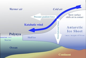 A wind that is created by air flowing downhill. When this air is warm, it may be called a foehn wind and when this air is cold or cool, it is called a drainage wind. Regionally it may be known as a mountain breeze or glacier wind. The opposite of an anabatic wind.
K-Index
The measure of thunderstorm potential based on the vertical temperature lapse rate, the moisture content of the lower atmosphere and the vertical extent of the moist layer.
Knot
(abbr. kt or kn) A nautical unit of speed equal to the velocity at which one nautical mile is travelled in one hour. Used primarily by marine interests and in weather observations. A knot is equivalent to 1.151 statute miles per hour or 1.852 kilometers per hour.
Klystron Amplifier
Klystron amplifiers are high power microwave vacuum tubes. Klystrons are velocity-modulated tubes that are used in some radar equipments as amplifiers. Klystrons make use of the transit-time effect by varying the velocity of an electron beam. A klystron uses one or more special cavities, which modulate the electric field around the axis the tube. Commonly used in Doppler Weather Radars.
Lapse Rate (of Temperature)
The rate of change of an atmospheric variable, usually temperature, with height. A steep lapse rate implies a rapid decrease in temperature with height (a sign of instability) and a steepening lapse rate implies that destabilization is occurring. The global average rate of temperature change with height in the atmosphere is 6.5°C/km. The adiabatic lapse rate (or dry adiabatic lapse rate) is the normal rate of change (9.8°C/km) for a dry parcel of air that is moved up or down and cools or warms as the pressure changes. The wet (moist) adiabatic lapse rate (4.9°C/km) is the rate at which saturated air cools as it ascends.
Large Scale (or Synoptic Scale)
Size scale referring generally to weather systems with horizontal dimensions of several hundred miles or more. Most high and low pressure areas seen on weather maps are synoptic-scale systems. Compare with mesoscale, storm-scale
Latent Heat
The specific enthalpy difference between two phases of a substance at the same temperature.
The latent heat of vaporization is the water vapour specific enthalpy minus the liquid water specific enthalpy. When the temperature of a system of dry air and water vapour is lowered to the dew point and water vapour condenses, the enthalpy released by the vapour heats the air–vapour– liquid system, reducing or eliminating the rate of temperature reduction. Similarly, when liquid water evaporates, the system must provide enthalpy to the vapour by cooling. The latent heat of fusion is the specific enthalpy of water minus that of ice and the latent heat of sublimation is the specific enthalpy of water vapour minus that of ice. The latent heats of vaporization, fusion, and sublimation of water at 0°C are, respectively.
Left Mover
A thunderstorm which moves to the left relative to the steering winds, and to other nearby thunderstorms; often the northern part of a splitting storm .
Lenticulat Clouds
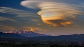 A cloud that generally has the form of a smooth lens. They usually appear in formation as the result of oragraphic origin. Viewed from the ground, the clouds appear stationary as the air rushes through them.
Lifted Index (or LI)
A common measure of atmospheric instability. Its value is obtained by computing the temperature that air near the ground would have if it were lifted to some higher level (around 18,000 feet, usually) and comparing that temperature to the actual temperature at that level. Negative values indicate instability - the more negative, the more unstable the air is, and the stronger the updrafts are likely to be with any developing thunderstorms. However there are no "magic numbers" or threshold LI values below which severe weather becomes imminent.
Longwave Radiation
Infrared radiation, radiation with wavelengths greater than those of the visible light (at about 8000 Angstroms or 800 nanometers (nm)) but shorter than those of microwaves (at about 1,000,000 Angstroms or 800,000 nm). Longwave radiation is associated with heat energy.
Low-level Jet
(LLJ) - A region of relatively strong winds in the lower part of the atmosphere. Specifically, it often refers to a southerly wind maximum in the boundary layer, common over the Plains states at night during the warm season.
The term also may be used to describe a narrow zone of strong winds above the boundary layer, but in this sense the more proper term would be low-level jet stream.
Low Pressure System
An area of a relative pressure minimum that has converging winds and rotates in the same direction as the earth. This is counter clockwise in the Northern Hemisphere and clockwise in the Southern Hemisphere. Also known as a cyclone, it is the opposite of an area of high pressure, or an anticyclone.
LP Storm
(or LP Supercell) Low-Precipitation storm (or Low-Precipitation supercell). A supercell thunderstorm characterized by a relative lack of visible precipitation. Visually similar to a classic supercell, except without the heavy precipitation core. LP storms often exhibit a striking visual appearance; the main tower often is bell-shaped, with a corkscrew appearance suggesting rotation. They are capable of producing tornadoes and very large hail. Radar identification often is difficult relative to other types of supercells, so visual reports are very important. LP storms almost always occur on or near the dry line , and thus are sometimes referred to as dry line storms .
Mammatus Clouds
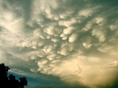 Rounded, smooth, sack-like protrusions hanging from the underside of a cloud (usually a thunderstorm anvil). Mammatus clouds often accompany severe thunderstorms, but do not produce severe weather; they may accompany non-severe storms as well.
mbar
An abbreviation for 'millibar', being one-thousandth part of a bar. The 'bar' is the basic unit of atmospheric pressure as defined in the c.g.s. system of measurement 1 bar = 103 millibars = 105 N/m2 (Pa) (SI system).
MCS
(abbr) Mesoscale Convective System. A complex of thunderstorms which becomes organized on a scale larger than the individual thunderstorms, and normally persists for several hours or more. MCSs may be round or linear in shape, and include systems such as tropical cyclones, squall lines, and MCCs (among others). MCS often is used to describe a cluster of thunderstorms that does not satisfy the size, shape, or duration criteria of an MCC.
Mean Wind
(abbr) Mesoscale Convective System. A complex of thunderstorms which becomes organized on a scale larger than the individual thunderstorms, and normally persists for several hours or more. MCSs may be round or linear in shape, and include systems such as tropical cyclones, squall lines, and MCCs (among others). MCS often is used to describe a cluster of thunderstorms that does not satisfy the size, shape, or duration criteria of an MCC.
Mean Sea Level
The average height of the sea surface water level. It is used as a basis for determining elevations, as the reference for all altitudes in upper air measurements, and as the level above which altitude is measured by a pressure altimeter for aviation. Often referred to as MSL..
Meridional
In meteorology, a flow, average, or functional variation taken in a direction that is parallel to a line of longitude; along a meridian; northerly or southerly; as opposed to zonal.
Mesohigh
A mesohigh (sometimes called a "bubble high") is a mesoscale high-pressure area that forms beneath thunderstorms. While not always the case, it is usually associated with a mesoscale convective system. In the early stages of research on the subject, the mesohigh was often referred to as a "thunderstorm high".
Mesolow
(or Sub-synoptic Low ) - A mesoscale low-pressure centre. Severe weather potential often increases in the area near and just ahead of a mesolow.
Mesolow should not be confused with mesocyclone, which is a storm-scale phenomenon.
Mesoscale
Size scale referring to weather systems smaller than synoptic-scale systems but larger than storm-scale systems. Horizontal dimensions generally range from around 50 miles to several hundred miles. Squall lines, MCCs , and MCSs are examples of mesoscale weather systems.
METAR
METeorological Aviation Report -- a weather observation for a specific airfield at a given time, containing the minimum information necessary for air operators for safe usage: wind/visibility/significant weather type/cloud amount+base / temperatures/pressure settings being the 'core' elements. Usually only issued with all elements when the airfield is operational (i.e. Air Traffic Control is open), but increasingly automated observations are now appearing of varying quality.
Major/civil airports issue at HH+20 and HH+50 (i.e. 20 and 50 minutes past each hour), with others hourly only. METAR reports may also have TREND forecasts appended giving a short-range (usually 2hr) forecast of significant changes. SPECI reports are issued when meteorological variables deteriorate/improve through defined levels.
Example of a METAR
Delhi Airport - VIDP 251200Z 31004G14KT 4000 HZ FEW040 38/07 Q1006 NOSIG
Mumbai Airport - VABB 251210Z 32008KT 5000 FU NSC 32/23 Q1007 NOSIG
Meteorology
Meteorology is the science of weather. It is essentially an inter-disciplinary science because the atmosphere, land and ocean constitute an integrated system. The three basic aspects of meteorology are observation, understanding and prediction of weather. There are many kinds of routine meteorological observations. Some of them are made with simple instruments like the thermometer for measuring temperature or the anemometer for recording wind speed. The observing techniques have become increasingly complex in recent years and satellites have now made it possible to monitor the weather globally. Countries around the world exchange the weather observations through fast telecommunications channels. These are plotted on weather charts and analysed by professional meteorologists at forecasting centres. Weather forecasts are then made with the help of modern computers and supercomputers. Weather information and forecasts are of vital importance to many activities like agriculture, aviation, shipping, fisheries, tourism, defence, industrial projects, water management and disaster mitigation. Recent advances in satellite and computer technology have led to significant progress in meteorology. Our knowledge of the weather is, however, still incomplete.
Microburst
A microburst is a very localized column of sinking air caused by a small and intense downdraft within a thunderstorm. There are two types of microbursts: wet microbursts and dry microbursts. They go through three stages in their life cycle: the downburst, outburst, and cushion stages. The scale and suddenness of a microburst makes it a great danger to aircraft due to the low-level wind shear caused by its gust front, with several fatal crashes having been attributed to the phenomenon over the past several decades.
Mid-leve Cooling
Local cooling of the air in middle levels of the atmosphere (roughly 8 to 25 thousand feet), which can lead to destabilization of the entire atmosphere if all other factors are equal.
Mintra
To aid the forecasting of condensation trails emitted (or not) from high-flying aircraft, a line marking the critical temperatures (altitude dependent), above which trails are not possible, is marked on a tephigram . The values are approximately -24degC at 1000 hPa (i.e. roughly sea-level), -39degC at 250 hPa (34000ft / 10.4 km) and about -45degC at 130 hPa (50000feet/15km). Using the MINTRA line (as it has come to be called - based on experiments by JK Bannon during World War II with the piston-engined Spitfire), a forecaster will mark two further lines on a tephigram: MINTRA minus 11degC (A) and MINTRA minus 14degC (B). If the ambient temperature (from the tephigram air temperature plot) lies between (A) and (B), then short, non-persistent trails are possible. If colder than (B), then long, persistent trails should be expected. However, some note should be paid to the relative humidity - high values will tip the balance to trailing (or longer/persistent trails.), even with air temperatures warmer than (A); ultra-low rh% will reduce the risk of condensation trails - the design of engines will have an effect as well. In broad terms, warm Tropical Maritime airmasses with a high but cold tropopause will result in a good deal of trailing, whilst cold, polar air-masses with a low, relatively warm tropopause will seldom give rise to significant aircraft trails.
Mist
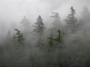 A suspension in the air consisting of an aggregate of microscopic water droplets or wet hygroscopic particles (of diameter not less than 0.5 mm or 0.02 in.), reducing the visibility at the earth's surface to not less than 1 km.
The term mist is used in weather reports when there is such obscurity and the associated visibility is 1000 m or more, and the corresponding relative humidity is 95% or more, but is generally lower than 100%. These hydrometeors form a thin greyish veil that covers the landscape. It also reduces visibility, but to a lesser extent than fog.
Moisture advection
Moisture advection is the horizontal transport of water vapour by the wind. Measurement and knowledge of atmospheric water vapour, or "moisture", is crucial in the prediction of all weather elements, especially clouds, fog, temperature, humidity thermal comfort indices and precipitation.
Monsoon
The seasonal shift of winds created by the great annual temperature variation that occurs over large land areas in contrast with associated ocean surfaces. The monsoon is associated primarily with the moisture and copious rains that arrive with the southwest flow across southern India. The name is derived from the word mausim, Arabic for season. This pattern is most evident on the southern and eastern sides of Asia, although it does occur elsewhere, such as in the south-western United States.
Morning Glory
An elongated cloud band, visually similar to a roll cloud , usually appearing in the morning hours, when the atmosphere is relatively stable. Morning glories result from perturbations related to gravitational waves in a stable boundary layer. They are similar to ripples on a water surface; several parallel morning glories often can be seen propagating in the same direction.
MRF
The MRF was one of the main models forecasters use for the medium range time period beyond 48 hours into the future. It is has been replaced by the Global Forecast System (GFS).
MSLP
(abbr) Mean sea level pressure. The mean sea level pressure (MSLP) is the atmospheric pressure at sea level or (when measured at a given elevation on land) the station pressure reduced to sea level assuming that the temperature falls at a lapse rate of 6.5 K per km in the fictive layer of air between the station and sea level.
Multi-cell Storm
These thunderstorms are organized in clusters of at least 2-4 short-lived cells. Each cell generates a cold air outflow and these individual outflows combine to form a large gust front. Convergence along the gust front causes new cells to develop every 5 to 15 minutes. The cells move roughly with the mean wind. However, the area (storm) motion usually deviates significantly from the mean wind due to discrete propagation (new cell development) along the gust front. The multicellular nature of the storm is usually apparent on radar with multiple reflectivity cores and maximum tops.
Multiple-vortex (or Multi-vortex) Tornado
A tornado in which two or more condensation funnels or debris clouds are present at the same time, often rotating about a common center or about each other. Multiple-vortex tornadoes can be especially damaging.
Negative-tilt Trough
An upper level system which is tilted to the west with increasing latitude (i.e., with an axis from southeast to northwest). A negative-tilt trough often is a sign of a developing or intensifying system.
Net Radiation
Difference in intensity between all incoming energy and all outgoing energy carried by both shortwave and longwave radiation.
NEXTRAD
NEXRAD or Nexrad (Next-Generation Radar) is a network of 159 high-resolution Doppler weather radars operated by the National Weather Service, an agency of the National Oceanic and Atmospheric Administration (NOAA) within the United States Department of Commerce. Its technical name is WSR-88D, which stands for Weather Surveillance Radar, 1988, Doppler. NEXRAD detects precipitation and atmospheric movement or wind. It returns data which when processed can be displayed in a mosaic map which shows patterns of precipitation and its movement. The radar system operates in two basic modes, selectable by the operator – a slow-scanning clear-air mode for analyzing air movements when there is little or no activity in the area, and a precipitation mode, with a faster scan for tracking active weather. NEXRAD has an increased emphasis on automation, including the use of algorithms and automated volume scans. Beijing Metstar Radar Company manufactures the next version of these radars.
Nimbostratus (NS)
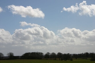 This cloud exhibits a combination of rain or snow, and sometimes the base of the cloud cannot be seen because of the heaviness of precipitation. They are generally associated with fall and winter conditions, but can occur during any season.
Noctilucent cloud (NLC)
A cloud that forms in one of the ionized layers of the ionosphere at about 80 kilometers above the Earth's surface, recently renamed polar mesospheric clouds. Noctilucent clouds look similar to cirrus clouds. They can only be seen at high latitudes, usually in the summer when the Sun is below the horizon.
Noctural Thunderstorm
Thunderstorms which develop after sunset. They are often associated with the strengthening of the low level jet and are most common over the Plains states. They also occur over warm water and may be associated with the seaward extent of the overnight land breeze.
Normal (environmental) lapse rate
The rate of decrease of temperature with elevation, -∂T/∂z, or occasionally ∂T/∂p, where p is pressure.
The concept may be applied to other atmospheric variables (e.g., lapse rate of density) if these are specified. The environmental lapse rate is determined by the distribution of temperature in the vertical at a given time and place and should be carefully distinguished from the process lapse rate, which applies to an individual air parcel.
North Atlantic Oscillation
The North Atlantic Oscillation (NAO) is a climatic phenomenon in the North Atlantic Ocean of fluctuations in the difference of atmospheric pressure at sea level between the Icelandic low and the Azores high. Through east-west oscillation motions of the Icelandic low and the Azores high, it controls the strength and direction of westerly winds and storm tracks across the North Atlantic. It is part of the Arctic oscillation, and varies over time with no particular periodicity.
NSC
(abbr) No significant cloud - (No CB, no cloud < 1500m/5000ft or below the highest minimum sector altitude, whichever is greater, and CAVOK is not appropriate); used in aviation forecasts (and latterly in actual).
Numerican Forcasting
The use of numerical models, such as the fundamental equations of hydrodynamics subjected to observed initial conditions, to forecast the weather. These models are run on high-speed computers at the National Centers for Environmental Prediction.
NWP
(abbr) Numerical weather prediction. (Also called mathematical forecasting, dynamical forecasting, physical forecasting.) The integration of the governing equations of hydrodynamics by numerical methods subject to specified initial conditions.
Numerical approximations are fundamental to almost all dynamical weather prediction schemes since the complexity and nonlinearity of the hydrodynamic equations do not allow exact solutions of the continuous equations.
OAT
(abbr) Outside air temperature: In aviation terminology, the outside air temperature (OAT) or static air temperature (SAT) refers to the temperature of the air around an aircraft, but unaffected by the passage of the aircraft through it. The outside air temperature is used in many calculations pertaining to flight planning, some of them being takeoff performance, density altitude, cruise performance and go-around performance. In most texts, the abbreviation, "OAT" is used.
OCF
Abbreviation for occluded front (or occlusion). Also known as an occlusion, it is a complex front formed when a cold front overtakes a warm front. It develops when three thermally different air masses conflict. The type of frontal boundary they create depends on the manner in which they meet. Related terms: cold front and warm front
Occluded front (OF)
(Commonly called occlusion; also called frontal occlusion.) A front that forms as a cyclone moves deeper into colder air.
This front will separate air behind the cold front from air ahead of the warm front. This is a common process in the late stages of wave-cyclone development, but is not limited to occurrence within a wave cyclone. There are three basic types of occluded front, determined by the relative coldness of the air behind the original cold front to the air ahead of the warm (or stationary) front. 1) A cold occlusion results when the coldest air is behind the cold front. The cold front undercuts the warm front and, at the earth's surface, coldest air replaces less cold air. 2) When the coldest air lies ahead of the warm front, a warm occlusion is formed, in which case the original cold front is forced aloft at the warm front surface. At the earth's surface, coldest air is replaced by less cold air. 3) A third and frequent type, a neutral occlusion, results when there is no appreciable temperature difference between the cold air masses of the cold and warm fronts. In this case frontal characteristics at the earth's surface consist mainly of a pressure trough, a wind-shift line, and a band of cloudiness and precipitation.
Occluded Mesocyclone
A mesocyclonein which air from the rear-flank downdraft has completely enveloped the circulation at low levels, cutting off the inflow of warm unstable low-level air.
Operational model (OP)
(abbr.) 'operational' model OPER (abbr.) 'operational' model
A term used to differentiate the primary NWP output from a particular centre from any ensemble products from the same source. The operational model will almost always be run at a higher resolution than that used for ensemble output. It must not, however be assumed that the 'Op/OPER' is necessarily the best outcome, particularly beyond 3 days or so.
Orographic forcing
An airstream encountering a barrier to its passage is forced to go around or over the obstacle. The upward deflection of the airflow is sufficient to give rise to adiabatic cooling, and if the air is moist enough, the formation of clouds, precipitation etc. In addition, convergence of the flow on the windward side (due to a rapid decrease in velocity) when the air encounters a sharply graded barrier not only enhances the vertical motion, but also leads to a deformation of the flow which in turn alters the vorticity of the air particles. Thus, hill and mountain ranges are most important in a study of meteorology.
Orographic lift
Orographic lift occurs when an air mass is forced from a low elevation to a higher elevation as it moves over rising terrain. As the air mass gains altitude it quickly cools down adiabatically, which can raise the relative humidity to 100 nd create clouds and, under the right conditions, precipitation.
Orographic rainfall/snowfall
Precipitation caused or enhanced by one of the mechanisms of orographic lifting of moist air.
Examples of precipitation caused by mountains include rainfall from orographic stratus produced by forced lifting and precipitation from orographic cumuli caused by daytime heating of mountain slopes. Many of the classic examples of locations having excessive annual precipitation are located on the windward slopes of mountains facing a steady wind from a warm ocean. As another example, wintertime orographic stratus (cap clouds) often produce the major water supply for populated semiarid regions such as the mountainous western United States, and as a result these cloud systems have been a target of precipitation enhancement, cloud-seeding projects intended to produce snowpack augmentation. Orographic precipitation is not always limited to the ascending ground, but may extend for some distance windward of the base of the barrier (upwind effect), and for a short distance to the lee of the barrier (spillover). The lee side with respect to prevailing moist flow is often characterized as the dry rain shadow.
Outflow Boundry
A storm-scale or mesoscale boundary separating thunderstorm-cooled air (outflow) from the surrounding air; similar in effect to a cold front, with passage marked by a wind shift and usually a drop in temperature. Outflow boundaries may persist for 24 hours or more after the thunderstorms that generated them dissipate, and may travel hundreds of miles from their area of origin. New thunderstorms often develop along outflow boundaries, especially near the point of intersection with another boundary (cold front , dry line , another outflow boundary, etc.
OVC
(abbr) OVerCast 8 oktas (cloud amount, as used in aviation reports, forecasts etc.)Overcast- An official sky cover classification for aviation weather observations, when the sky is completely covered by an obscuring phenomenon. This is applied only when obscuring phenomenon aloft are present--that is, not when obscuring phenomenon are surface-based, such as fog
Overconvection
The promise of a fine, sunny day is sometimes spoiled because cumulus cloud builds and spread out into an almost unbroken sheet of stratocumulus by late morning - which then refuses to break up for the rest of the day*. For this to occur, there must be a marked inversion (see "What is an inversion?") within 100 to 300 hPa of the surface, which must be intense enough to stop convective currents 'breaking - through' the inversion even at maximum temperature; the convective condensation level (CCL) must be at least 60 hPa below the inversion level, and the layer between CCL and inversion must have a reasonably high relative humidity.
Over-running trough
An active, mid-latitude frontal system is associated with a marked short-wave trough. The 'active' weather associated with the front lies forward of the trough, driven by the dynamics associated with it. At some stage in its life though, the trough (or a portion of it) will 'relax' (and effectively weaken), allowing the trough to run well ahead of the lower-tropospheric portion of the frontal system - it 'over-runs' the (surface) location of the front, and the activity at that position will decay.
Overshooting Top (or Penetrating Top)
A dome-like protrusion above a thunderstorm anvil, representing a very strong updraftand hence a higher potential for severe weather with that storm. A persistent and/or large overshooting top (anvil dome) often is present on a supercell. A short-lived overshooting top, or one that forms and dissipates in cycles, may indicate the presence of a pulse storm or a cyclic storm.
Pa
Pascal - The SI derived unit of pressure.
One pascal (Pa) is equal to 1 newton m-2.
The kilopascal (kPa) is the preferred unit for atmospheric pressure, but the more familiar millibar (mb) is the unit of pressure generally used by meteorologists, by international agreement; 1 mb = 1 hPa (hectopascal). For a typical sea level pressure, 102.345 kPa = 1023.45 hPa = 1023.45 mb.
Parametrisation
Some atmospheric processes are below the grid-scale/wavelength of operational meteorological computer models and cannot be handled explicitly by such schemes - for example individual showers, which are not only important for local weather, but have a feedback effect within the atmosphere that needs to be included in the NWP routines to maintain a realistic model of the real atmosphere. Larger scale model parameters (e.g. wind vector, temperature, humidity) are used to diagnose and represent the effects of such sub-gridscale processes: this is know as parametrisation.
Partial drought
In British climatology, a relative drought period of at least 29 consecutive days during which the average daily rainfall does not exceed 0.01 in.
Partly Cloudy
The state of the weather when the clouds are conspicuously present, but do not completely dull the sky or the day at any moment. The National Weather Service does not have an amount of sky cover for this condition.
Perihelion
The point of the earth's orbit that is nearest to the sun. Although the position is part of a 21,000 year cycle, currently it occurs around January, when the earth is about 3 million miles closer to the sun than at aphelion. This term can be applied to any other celestial body in orbit around the sun. It is the opposite of aphelion.
PGF
(abbr) Pressure gradient force. A three-dimensional force vector operating in the atmosphere that accelerates air parcels away from regions of high pressure and toward regions of low pressure in response to an air pressure gradient. Usually resolved into vertical and horizontal components.
Phenology
The science that treats the periodic biological phenomena with relation to climate, especially seasonal changes.
Phenological events are stages of plant growth. From a climatological viewpoint, these phenomena serve as bases for the interpretation of progress in local seasons and the climatic zones, and are considered to integrate the effects of a number of bioclimatic factors on rate of plant development. Phenology may be considered a branch of the science of bioclimatics, the sequence of plant or crop development stages through its life cycle. Growth stages may be defined by stage of physiological development such as germination, first true leaf, flowering, maturity, etc., and/or by physical stage such as planting, emergence, harvest, etc.
Pilot Balloon
A small balloon whose ascent is used to determine the direction and speed of low level atmospheric winds. Also known as a pibal.
PL
(abbr) Ice Pellets (was PE); used in aviation weather reports. Precipitation in the form of transparent or translucent pellets of ice, which are round or irregular in shape. They have a diameter of 0.2 inches (5 mm) or less. They are classified into two types: hard grains of ice consisting of frozen rain drops or largely melted and refrozen snowflakes; pellets of snow encased in a thin layer of ice which have formed from the freezing of droplets intercepted by pellets or water resulting from the partial melting of pellets. It is reported as "PE" in an observation and on the METAR. Also known as sleet.
Plan Position Indicator
Also known as a PPI Scope, it is a radar indicator scope displaying range and azimuth of targets in polar coordinates.
PMC
(abbr) Polar mesospheric clouds. (Abbreviated PMC.) Cirrus-like clouds seen from spacecraft over the polar regions during summer in both hemispheres.
They occur near the mesopause, at heights of roughly 85 km, and are closely related to noctilucent clouds.
Polar front
A semi-continuous, semi-permanent boundary between polar air masses and tropical air masses. An integral part of an early meteorological theory known as the Polar Front Theory.
Polar low
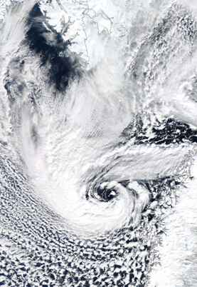 A small but intense cyclone that forms in cold polar air advected over warmer water.
These vortices often form in the subpolar North Pacific and subpolar North Atlantic equatorward of the sea ice margin. Horizontal scales range from several tens to several hundreds of kilometers. Because of strong winds and intense precipitation, these cyclones are sometimes referred to as "arctic hurricanes."
Polar mesocyclones
A term now used to encompass the whole 'family' of disturbances resulting from arctic air flowing equatorward over progressively warmer seas; the term 'Polar Low' (q.v/above) is now often used only for 'extreme' systems where gale or near gale-force winds are observed.
A small but intense cyclone that forms in cold polar air advected over warmer water. These vortices often form in the subpolar North Pacific and subpolar North Atlantic equatorward of the sea ice margin. Horizontal scales range from several tens to several hundreds of kilometers. Because of strong winds and intense precipitation, these cyclones are sometimes referred to as "arctic hurricanes."
Polar mesospheric clouds
(Abbreviated PMC.) Cirrus-like clouds seen from spacecraft over the polar regions during summer in both hemispheres.
They occur near the mesopause, at heights of roughly 85 km, and are closely related to noctilucent clouds.
Pollutant
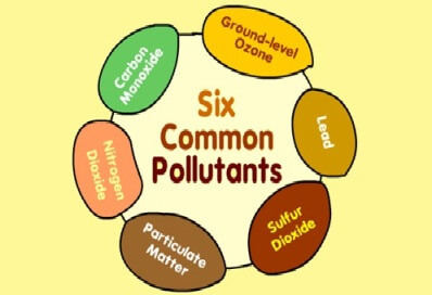 Particles, gases, or liquid aerosols in the atmosphere which have an undesirable effect on humans or their surroundings. Something unfavourable to health and life that has been added to the environment.
Positive CG
A CG flash that delivers positive charge to the ground, as opposed to the more common negative charge. Positive CGs have been found to occur more frequently in some severe thunderstorms. Their occurrence is detectable by most lightning detection networks, but visually it is not considered possible to distinguish between a positive CG and a negative CG.
Positive-tilt Trough
An upper level system which is tilted to the east with increasing latitude (i.e., from southwest to northeast). A positive-tilt trough often is a sign of a weakening weather system, and generally is less likely to result in severe weather than a negative-tilt trough if all other factors are equal.
Potential Instability
(Also called convective instability, thermal instability.) The state of an unsaturated layer or column of air in the atmosphere with a wet-bulb potential temperature (or equivalent potential temperature) that decreases with elevation.
If such a column is lifted bodily until completely saturated, it will become unstable (i.e., its temperature lapse rate will exceed the saturation-adiabatic lapse rate) regardless of its initial stratification.
Potential Temperature
The temperature a parcel of dry air would have if brought adiabatically (i.e., without transfer of heat or mass) to a standard pressure level of 1000 mb.
Potential Vorticity
This plays an important role in the generation of vorticity in cyclogenesis, especially along the polar front. It is also very useful in tracing intrusions of stratospheric air deep into the troposphere in the vicinity of jet streaks.
PPINE
Plan Position Indicates No Echoes, referring to the fact that a radar detects no precipitation within its range.
Precipitation
1. The process where water vapour condenses in the atmosphere to form water droplets that fall to the Earth as rain, sleet, snow, hail, etc.
2. As used in hydrology, precipitation is the discharge of water, in a liquid or solid state, out of the atmosphere, generally onto a land or water surface. It is the common process by which atmospheric water becomes surface, or subsurface water. The term "precipitation" is also commonly used to designate the quantity of water that is precipitated. Precipitation includes rainfall, snow, hail, and sleet, and is therefore a more general term than rainfall.
Pressure Gradient
(In meteorology, also called barometric gradient.) The rate of decrease (gradient) of pressure in space at a fixed time.
Pressure Gradient Force
A three-dimensional force vector operating in the atmosphere that accelerates air parcels away from regions of high pressure and toward regions of low pressure in response to an air pressure gradient. Usually resolved into vertical and horizontal components.
Prevailing visibility
The visibility that is considered representative of conditions at the station; the greatest distance that can be seen throughout at least half the horizon circle, not necessarily continuous.
PRFG
Partial fog ( visibility < 1000m.) A substantial part of the station covered by fog while the remainder is clear of fog
PROB
Probability (as used in aviation forecasts, e.g. TAFs; in the latter, under current [2002] rules, only PROB30 or PROB40 are allowed, e.g. 'moderate' probability of an event occurring.
Probability forecasting
A forecast of the probability that one or more of a mutually exclusive set of weather conditions will occur.
Profiler
An instrument designed to measure horizontal winds directly above its location, and thus measure the vertical wind profile. Profilers operate on the same principles as Doppler radar .
Progression
When large scale features in the upper air, such as a 500 or 300 hPa trough/vortex drift west-to-east this is said to be a 'normal' progression of the pattern.
PSC
 (abbr: Polar Stratospheric Clouds also called nacreous clouds, mother-of-pearl clouds; rarely, luminous clouds.) Clouds are cirrus or altocumulus lenticularis, and show very strong irisation similar to that of mother-of-pearl, especially when the sun is several degrees below the horizon.
They occur at heights about 20–30 km above the earth. These clouds are rarely seen, and it would appear that they can be observed only in certain regions.
Pulse
A very short duration of time. In regard to a radar, it is a brief burst of a electromagnetic radiation emitted by the radar.
Pulse storms
A thunderstorm within which a brief period (pulse) of strong updraft occurs, during and immediately after which the storm produces a short episode of severe weather. These storms generally are not tornado producers, but often produce large hail and/or damaging winds. See overshooting top and cyclic storm.
PVA region
A region of positive vorticity usually several hundred of kilometers wide on a upper level chart that moves with the general wind flow. It aids in weather prediction by showing where regions of rising air. This usually results in clouds and precipitation.
Pyranometer
An instrument with a hemispherical field of view, used for measuring total or global solar radiation, specifically global horizontal radiation; a pyranometer with a shadow band or shading disk blocking the direct beam measures the diffuse sky radiation
Pyrheliometer
Instrument with a narrow ( circumsolar) field of view which measures direct normal irradiance. Pyrheliometers are mounted on sun-following trackers so that the instrument is always aimed at the sun.
QFE
QFE, a Q code used by pilots and air traffic control that refers to atmospheric pressure and altimeter settings
QFF
QFF is a Q code. It is the MSL pressure derived from the barometric pressure at the station location by calculating the weight of an imaginary air column, extending from the location to sea level, assuming the temperature and relative humidity at the location are the long term monthly mean, the temperature lapse rate is according to ISA and the relative humidity lapse rate is zero.
QNH
QNH is one of the many Q codes. It is defined as, "barometric pressure adjusted to sea level." It is a pressure setting used by pilots, air traffic control (ATC), and low frequency weather beacons to refer to the barometric setting which, when set on an aircraft's altimeter, will cause the altimeter to read altitude above mean sea level within a certain defined region. Within United Kingdom airspace, these are known as Altimeter Setting Regions (ASRs); these regions may be large areas, or apply only to the airfield for which the QNH was given. An airfield QNH will cause the altimeter to show airfield altitude, that is, the altitude of the centre point of the main runway above sea level on landing, irrespective of the temperature.
QPF
(Abbr) Quantitative Precipitation Forecast. A forecast of rainfall, snowfall or liquid equivalent of snowfall.
Quasi-Stationary Front
A front which is nearly stationary or moves very little since the last synoptic position. Also known as a stationary front.
RA
(abbr) Rain; as used in aviation (e.g. METAR/TAF) reports. Precipitation in the form of liquid water droplets greater than 0.5 mm. If widely scattered, the drop size may be smaller. It is reported as "R" in an observation and on the METAR. The intensity of rain is based on rate of fall.
RADAR
Acronym for RAdio Detection And Ranging. An electronic instrument used to detect distant objects and measure their range by how they scatter or reflect radio energy. Precipitation and clouds are detected by measuring the strength of the electromagnetic signal reflected back.
Radio frequency band
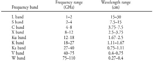 A frequency band of microwave radiation within which radars operate. The radar frequency bands were first designated by code letters for secrecy during World War II; these letters are still in common use, although the exact frequency intervals to which they apply have undergone some redefinition.
They all fall within the UHF, SHF, and EHF radio frequency bands. The bands normally used for radar detection of precipitation and clouds are the following.
Radars operating in the S, C, and X bands are the ones mainly used for precipitation measurements. Attenuation of the transmitted radio frequency energy by atmospheric gases, precipitation, and cloud particles is severe for all frequency bands higher than X band, and even X band can suffer severe attenuation in heavy rain. Nevertheless, because radars operating in the K, Ka, and W bands are able to detect clouds, they are used for cloud observations even though they are not able to penetrate far through precipitation. Radar wind profilers and MST radars operate at lower frequencies than those included in this table, namely, in the UHF
Radiation
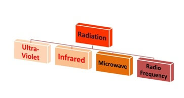 Energy emitted in the form of electromagnetic waves. Radiation has differing characteristics depending upon the wavelength. Radiation from the Sun has a short wavelength (ultra-violet) while energy re-radiated from the Earth's surface and the atmosphere has a long wavelength (infra-red).
Radiation Fog
Fog that is created when radiational cooling at the earth's surface lowers the temperature of the air near the ground to or below its dew point. Formation is best when there is a shallow surface layer of relatively moist air beneath a drier layer, clear skies, and light surface winds. This primarily occurs during the night or early
Radial Velocity
Component of motion toward or away from a given location. As "seen" by Doppler radar , it is the component of motion parallel to the radar beam. (The component of motion perpendicular to the beam cannot be seen by the radar. Therefore, strong winds blowing strictly from left to right or from right to left, relative to the radar, cannot be detected.)
Radial frequency band
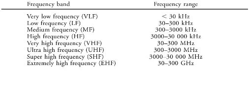 A specified range of frequencies of electromagnetic waves.
These bands, based on multiples of 3, are a consequence of the speed of light being very nearly equal to 3 x 10⁸ m s-1. Thus, VHF corresponds to free-space wavelengths 1–10 m and so on.
Radiosonde
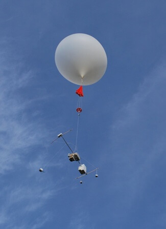 (sometimes abbreviated to 'R/S') An instrument attached to a weather balloon used to measure pressure, temperature, humidity, and winds aloft. Observations are made when the radiosonde is aloft and emits radio signals as it ascends. May be referred to as a RAOB, an acronym for RAdiosonde OBservation.
Rain Day
(Also called day of rain.) In climatology, a period of 24 hours, normally commencing at 0900 UTC, in which at least 0.01 in. or 0.2 mm of precipitation is recorded. Or a "day with measurable precipitation" or "day with 0.01 inch or more" (of precipitation).
Rain-free Base
A dark, horizontal cloud base with no visible precipitation beneath it. It typically marks the location of the thunderstorm updraft . Tornadoes may develop from wall clouds attached to the rain-free base, or from the rain-free base itself - especially when the rain-free base is on the south or southwest side of the main precipitation area.
Note that the rain-free base may not actually be rain free; hail or large rain drops may be falling. For this reason, updraft base is more accurate.
Range Resolution
The ability of radar to distinguish between targets on the same azimuth but at different ranges.
Rear Flank Downdraft
(or RFD) - A region of dry air subsiding on the back side of, and wrapping around, a mesocyclone . It often is visible as a clear slot wrapping around the wall cloud. Scattered large precipitation particles (rain and hail) at the interface between the clear slot and wall cloud may show up on radar as a hook or pendant ; thus the presence of a hook or pendant may indicate the presence of an RFD.
Reflectivity
Radar term referring to the ability of a radar target to return energy; used to derive echo intensity, and to estimate precipitation intensity and rainfall rates. Also referred as dBZ .
Relative humidity (RH) (abbr) (expressed as a % value).
A type of humidity that considers the ratio of the actual vapour pressure of the air to the saturation vapour pressure. It is usually expressed in percentage.
Ratio that compares the amount of water vapour in the air to the saturation amount. The ratio of the mixing ratio of the ambient air and the saturation mixing ratio of the same air with the same pressure and temperature. Relative humidity is usually expressed as a percentage. When using relative humidity as an indication of absolute moisture quantity, caution must be used, because colder air has a smaller saturation mixing ratio than warmer air.
Relative Vorticity
(Also called local vorticity.) The vorticity as measured in a system of coordinates fixed on the earth's surface.
Usually, only the vertical component of the vorticity is meant.
Relaxation
When the amplitude of a trough decreases with time, the trough is said to have undergone relaxation. The change is usually measured in terms of a latitude change of a chosen contour or thickness line.
Retrogression
In meteorology, it is the movement of a weather system in a direction opposite to the direction of the basic flow in which it is embedded. Often used in reference to a long wave trough or other macroscale feature. For example, a long wave trough that may move slightly westward when the "normal" movement and flow is eastward.
Movement of a weather system in a direction opposite to that of the basic flow in which it is embedded, usually referring to a closed low or a longwave trough which moves westward.
Ridge
 1. An elongated area of relatively high atmospheric pressure; the opposite of trough.
2. In hydrologic terms, a line or wall of broken ice forced up by pressure. May be fresh or weathered
Right Mover
A thunderstorm that moves appreciably to the right relative to the main steering winds and to other nearby thunderstorms. Right movers typically are associated with a high potential for severe weather. (Supercells often are right movers.)
Roll Cloud
A low, horizontal tube-shaped arcus cloud associated with a thunderstorm gust front (or sometimes with a cold front ). Roll clouds are relatively rare; they are completely detached from the thunderstorm base or other cloud features, thus differentiating them from the more familiar shelf clouds . Roll clouds usually appear to be "rolling" about a horizontal axis, but should not be confused with funnel clouds.
Rope Cloud
In satellite meteorology, a narrow, rope-like band of clouds sometimes seen on satellite images along a front or other boundary.
The term sometimes is used synonymously with rope or rope funnel.
RUC
Rapid Update Cycle, a numerical model run at NCEP that focuses on short-term (up to 12 h) forecasts and small-scale (mesoscale) weather features. Forecasts are prepared every 3 hours for the contiguous United States.
Runway Visual Range (RVR)
It is the maximum distance at which the runway, or the specified lights or markers delineating it, can be seen from a position above a specified point on its centre line. This value is normally determined by visibility sensors located alongside and higher than the centre line of the runway. RVR is calculated from visibility, ambient light level, and runway light intensity.
SA
(abbr) Sand, visibility 5000m or less. Loose particles of hard, broken rock or minerals. In observing, sand is reported when particles of sand are raised to sufficient height that reduces visibility. It is reported as "SA" in an observation and on the METAR. (as used in aviation reports, forecasts etc.)
SALR
(abbr) Saturated adiabatic lapse rate. When the air is saturated with water vapour (at its dew point), the moist adiabatic lapse rate (MALR) or saturated adiabatic lapse rate (SALR) applies. This lapse rate varies strongly with temperature. A typical value is around 5 °C/km (2.7 °F/1,000 ft) (1.5°C/1,000 ft).
Saturated Air
The condition in which vapour pressure is equal to the equilibrium vapour pressure over a plane surface of pure liquid water, or sometimes ice.
Saturation
Rapid Update Cycle, a numerical model run at NCEP that focuses on short-term (up to 12 h) forecasts and small-scale (mesoscale) weather features. Forecasts are prepared every 3 hours for the contiguous United States.
SC
 (abbr) Stratocumulus (SC in METAR/SIGWX charts etc., Sc otherwise); A low cloud composed of layers or patches of cloud elements. It can form from cumulus clouds becoming more stratiformed and often appears as regularly arranged elements that may be tessellated, rounded, or roll-shaped with relatively flat tops and bases. It is light or dark gray in color, depending on the size of the water droplets and the amount of sunlight that is passing through them.
Gray and/or whitish patches, sheets, or layers of clouds composed of rounded masses or rolls, which are nonfibrous and which may or may not be merged. Stratocumulus clouds can result when layers of clouds are heated from below and convection follows. Stratocumulus clouds, one of four genera that are hybrids of cumulus clouds, are made up of water drops and possibly hail and snow. They are very common over portions of the world's oceans and are thought to be very important in determining the Earth's radiation budget.
SCT
(abbr) Scattered (3 or 4 oktas); An official sky cover classification for aviation weather observations, descriptive of a sky cover of 3/8 to 4/8. This is applied only when obscuring phenomenon aloft are present--that is, not when obscuring phenomenon are surface-based, such as fog.
A National Weather Service convective precipitation descriptor for a 30%, 40%, and 50% chance of measurable precipitation
SCUD
Low fragments of clouds, usually stratus fractus, that are unattached and below a layer of higher clouds, either nimbostratus or cumulonimbus. They are often along and behind cold fronts and gust fronts, being associated with cool moist air, such as an outflow from a thunderstorm. When observed from a distance, they are sometimes mistaken for tornadoes.
Seasons
A division of the year according to some regularly recurrent phenomena, usually astronomical or climatic.
Seclusion Process
occluded front is not appropriate. What appears to happen is that the original cold front becomes weak/ill-defined (close to the low centre), and a new cold front appears further to the west. (This is effectively what has been drawn in the past as a 'back-bent' occlusion). So, what happens to the warm air associated with the warm frontal zone near the low centre? Around and immediately to the equatorward side of the low, it becomes trapped or 'secluded' from the rest of the development in a discrete region enclosed by relatively colder air encircling the development - a so-called 'seclusion'. (This is therefore a different process from that producing the classical 'occlusion' whereby warm-sector air is lifted by the advancing cold air.)
Seeder/Feeder Mechanism
Orographic precipitation-enhancement mechanism, in which precipitation from an upper-level precipitating cloud (seeder) falls through a lower-level orographic stratus cloud (feeder) capping a hill or small mountain.
Precipitation droplets or ice particles fall from the higher seeder cloud and collect cloud water as they pass through the lower feeder cloud by collision and coalescence or accretion, thus producing greater precipitation on the hill under the cap cloud than on the nearby flat land. The effectiveness of the process depends on sufficiently strong low-level moist flow to maintain the cloud water content in the orographic feeder cloud and the continuing availability of precipitation particles from the seeder cloud.
Sensible heat transfer
The transfer of heat by conduction and convection (i.e. it can be 'sensed' or detected directly).
Severe Gale
The definition of a 'Severe Gale/Force 9' is strict for operational forecasting for maritime purposes. Either the mean (10 minute) wind must be 41 knots or more, up to 47 knots; or the gusts must be 52 knots or more, up to 60 knots. The term will also be heard on broadcast weather forecasts, although it's arguable that the general population cannot be expected to know what this definition is, and the practice now is to explicitly forecast gust values rather than just relying on the adjective 'severe' to imply possible problems.
Severe Thunderstorm
A thunderstorm which produces tornadoes , hail 0.75 inches or more in diameter, or winds of 50 knots (58 mph) or more. Structural wind damage may imply the occurrence of a severe thunderstorm. See approaching (severe).
SG
(abbr) Snow grains; as used in aviation weather reports. Frozen precipitation in the form of very small, white, opaque grains of ice. The solid equivalent of drizzle. It is reported as "SG" in an observation and on the METAR.
SH
(abbr) Showers; as used in aviation weather reports/forecasts. Precipitation from a convective cloud that is characterized by its sudden beginning and ending, changes in intensity, and rapid changes in the appearance of the sky. It occurs in the form of rain (SHRA), snow (SHSN), or ice (SHPE). It is reported as "SH" in an observation and on the METAR.
A descriptor, SH, used to qualify precipitation characterized by the suddenness with which they start and stop, by the rapid changes of intensity, and usually by rapid changes in the appearance of the sky:
Shear
Variation in wind speed (speed shear ) and/or direction (directional shear ) over a short distance. Shear usually refers to vertical wind shear, i.e., the change in wind with height, but the term also is used in Doppler radar to describe changes in radial velocity over short horizontal distances.
Shear vorticity
Shear vorticity is found by comparing the wind at two locations at the same pressure level. Both produce an eddy of rotating air
Shelf Cloud
A low, horizontal wedge-shaped arcus cloud , associated with a thunderstorm gust front (or occasionally with a cold front, even in the absence of thunderstorms). Unlike the roll cloud , the shelf cloud is attached to the base of the parent cloud above it (usually a thunderstorm). Rising cloud motion often can be seen in the leading (outer) part of the shelf cloud, while the underside often appears turbulent, boiling, and wind-torn.
Shortwave
A disturbance in the mid or upper part of the atmosphere which induces upward motion ahead of it. If other conditions are favorable, the upward motion can contribute to thunderstorm development ahead of a shortwave.
SIGMET
SIGMET, or Significant Meteorological Information, is a weather advisory that contains meteorological information concerning the safety of all aircraft. There are two types of SIGMETs - convective and non-convective. The criteria for a non-convective SIGMET to be issued are severe or greater turbulence over a 3,000-square-mile (7,800 km2) area, severe or greater icing over a 3,000-square-mile (7,800 km2) area or IMC conditions over a 3,000-square-mile (7,800 km2) area due to dust, sand, or volcanic ash.
A Convective SIGMET is issued for convection over the Continental U.S. Convective SIGMETs are issued for an area of thunderstorms affecting an area of 3,000 square miles (7,800 km2) or greater, a line of thunderstorms at least 60 nm long, severe thunderstorms or embedded thunderstorms affecting any area that are expected to last 30 minutes or longer. Severe thunderstorms are characterized by tornado(s), hail 3/4 inches or greater, or wind gusts 50 knots or greater. A Convective SIGMET is valid for 2 hours and they are issued every hour + 55 min.
Significant Wave Height
Defined traditionally as the mean height of the highest third of the waves, but now usually defined as four times the root-mean-square of the surface elevation (or equivalently as four times the square root of the first moment of the wave spectrum).
SIGWX
(abbr) SIGWX is a Significant Weather Chart defined by ICAO.
Weather charts being issued by World Area Forecast Centres (from meteorological offices in London and Washington), presenting the most important meteorological phenomena relevant especially for air traffic transport. WAFC publishes them in two formats
BUFR code
PNG images
Charts are typically being issued every six hours (0, 6, 12, 18 UTC) and contain forecast valid for next 12 hours. Prognoses are typically prepared for two ranges of heights:
SWH - High Level SIGWX (Flight level 250-630)
SWM - Medium Level SIGWX (Flight level 100-450)
Singularities
Climatologists have always been alive to the fact that similar weather patterns/types occur at certain times of the year with varying degrees of regularity - an annual 'singularity'. For a while, before dynamical methods of long-range forecasting were used, singularities were very popular, though controversial. The best known (in the British Isles) are Buchan's spells and Lamb's singularities.
SKC
(abbr) Sky clear (as used in aviation weather reports, though from 2005, it should NOT be used in METAR reports).
Sleet
Sleet is defined as pellets of ice composed of frozen or mostly frozen raindrops or refrozen partially melted snowflakes. These pellets of ice usually bounce after hitting the ground or other hard surfaces.
SMOKE
Small particles produced by combustion that are suspended in the air. A transition to haze may occur when the smoke particles have travelled great distance (25 to 100 kms or more), and when the larger particles have settled out. The remaining particles become widely scattered through the atmosphere. It is reported as "FU" in an observation and on the METAR.
SN
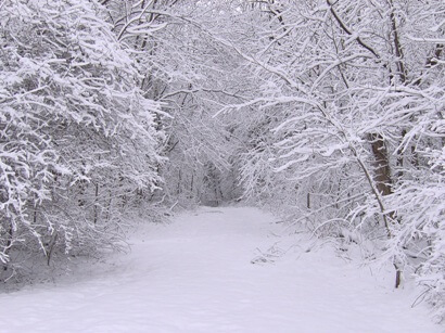 (abbr) Snow (as used in aviation weather reports, forecasts etc.) Precipitation in the form of ice crystals, mainly of intricately branched, hexagonal form and often agglomerated into snowflakes, formed directly from the freezing [deposition] of the water vapour in the air.
Snow-line
The lowest elevation area of a perennial snow field on high terrain, such as mountain range
Snow Pellets
Frozen precipitation in the form of white, round or conical opaque grains of ice. Their diameter ranges from 2 to 5 mm. They are easily crushed and generally break up after rebounding from a hard surface, unlike hail. Sometimes it is called small or soft hail. It is reported as "GS" in an observation and on the METAR.
SNOWTAM
(more correctly - runway state report) A SNOWTAM is a message describing the conditions of the runways, taxiways and apron at an aerodrome. During the winter season a SNOWTAM will be issued each day in the morning, before flying starts. A SNOWTAM is valid for 24 hours, but there are rules stating that a new SNOWTAM shall be issued sooner if significant changes occur.
Solar Tracker
A solar tracker is a device that orients a payload toward the sun. Payloads can be photovoltaic panels, reflectors, lenses or other optical devices.
Solar Radiation
Radiation emitted by the Sun. It is also referred to as short-wave radiation. Solar radiation has a distinctive range of wavelengths (spectrum) determined by the temperature of the Sun.
Source Region
Extensive region of the earth's surface characterized by essentially uniform surface conditions, and so located with respect to the general atmospheric circulation pattern that a volume of air remains in contact with the surface long enough to acquire properties that distinguish it as an air mass
SPECI
A special report or forecast (SPECI) is issued whenever significant changes have occurred or are expected to occur to the published report or forecast. These are published in the SPECI code format. The SPECI code is similar to the METAR/TAF code.
Specific Heat
(Or specific heat capacity.) The heat capacity of a system divided by its mass.
It is a property solely of the substance of which the system is composed. As with heat capacities, specific heats are commonly defined for processes occurring at either constant volume (cv) or constant pressure (cp). For an ideal gas, both are constant with temperature and related by cp = cv + R with R the gas constant.
Specific Humidity
The ratio of the density of the water vapour to the density of the air, a mix of dry air and water vapour. It is expressed in grams per gram or in grams per kilograms. The specific humidity of an air parcel remains constant unless water vapour is added to or taken from the parcel.
Speed Shear
The component of wind shear which is due to a change in wind speed with height, e.g., southwesterly winds of 20 mph at 10,000 feet increasing to 50 mph at 20,000 feet. Speed shear is an important factor in severe weather development, especially in the middle and upper levels of the atmosphere.
Splitting Storm
A thunderstorm which splits into two storms which follow diverging paths (a left mover and a right mover ). The left mover typically moves faster than the original storm, the right mover, slower. Of the two, the left mover is most likely to weaken and dissipate (but on rare occasions can become a very severe anticyclonic-rotating storm), while the right mover is the one most likely to reach supercell status.
Squall (SQ)
(abbr) Squall(s) (as defined below - used in aviation weather reports). A sudden onset of strong winds with speeds increasing to at least 16 knots (18 miles per hour) and sustained at 22 or more knots for at least one minute. The intensity and duration is longer than that of a gust. It is reported as "SQ" in an observation and on the METAR.
SS
(abbr) Sandstorm (vis generally < 1km); as used in aviation weather reports, forecasts etc. A strong wind carrying sand particles through the air. They are low level occurrences, usually only ten feet in height to not more than fifty feet above the surface. Due to the frequent winds created by surface heating, they are most predominate during the day and die out in the night. It is reported as "SS" in an observation and on the METAR.
SST
Radiation emitted by the Sun. It is also referred to as short-wave radiation. Solar radiation has a distinctive range of wavelengths (spectrum) determined by the temperature of the Sun.
ST
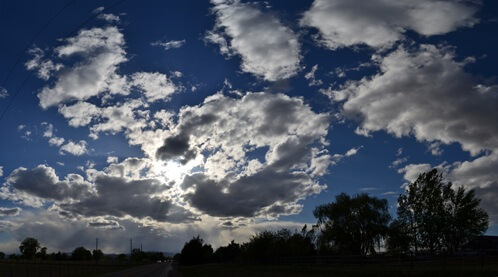 Stratus (ST in METAR, aviation charts etc., St otherwise); A low, generally gray cloud layer with a fairly uniform base. Stratus may appear in the form of ragged patches, but otherwise does not exhibit individual
cloud elements as do cumulus and stratocumulus clouds . Fog usually is a surface-based form of stratus.
Stable air
Air is stable when an air parcel sinks or rises to its original position, when the force that initially moved it is no longer operating.
Staccato Lighting
A CG lightning discharge which appears as a single very bright, short-duration stroke, often with considerable branching.
Standard Atmosphere
A standard atmosphere has been defined by the International Civil Aeronautical Organization (ICAO). It assumes a mean sea level temperature of 15°C a standard sea level pressure of 1,013.25 millibars of mercury, and a temperature lapse rate of 0.65°C per 100 meters up to 11 kilometres in the atmosphere.
Storm
An individual low pressure disturbance, complete with winds, clouds, and precipitation. The name is associated with destructive or unpleasant weather. Storm-scale refers to disturbances the size of individual thunderstorms.
Storm surge
An abnormal rise in sea level accompanying a hurricane or other intense storm, and whose height is the difference between the observed level of the sea surface and the level that would have occurred in the absence of the cyclone. Storm surge is usually estimated by subtracting the normal or astronomic high tide from the observed storm tide.
Stratocu-Cugen
 Stratocumulus (Sc) A low cloud composed of layers or patches of cloud elements. It can form from cumulus clouds becoming more stratiformed and often appears as regularly arranged elements that may be tessellated, rounded, or roll-shaped with relatively flat tops and bases. It is light or dark gray in color, depending on the size of the water droplets and the amount of sunlight that is passing through them.
Stratosphere
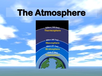 The layer of the atmosphere located between the troposphere and the mesosphere, characterized by a slight temperature increase and absence of clouds. It extends between 17 to 50 kilometres above the earth's surface. It is the location of the earth's ozone layer.
Stratiform
Having extensive horizontal development, as opposed to the more vertical development characteristic of convection. Stratiform clouds cover large areas but show relatively little vertical development. Stratiform precipitation, in general, is relatively continuous and uniform in intensity (i.e., steady rain versus rain showers).
Striations
Grooves or channels in cloud formations, arranged parallel to the flow of air and therefore depicting the airflow relative to the parent cloud. Striations often reveal the presence of rotation, as in the barber pole or "corkscrew" effect often observed with the rotating updraft of an LP storm.
Streamlines
A line with its tangent at any point in a fluid parallel to the instantaneous velocity of the fluid at that point.
The differential equations of the streamline may be written dr × v = 0, where dr is an element of the streamline and v the velocity vector; or in Cartesian coordinates, dx/u = dy/v = dz/ w, where u, v, and w are the fluid velocities along the orthogonal x, y, and z axes, respectively. In steady-state flow the streamlines coincide with the trajectories of the fluid particles; otherwise, the streamline pattern changes with time.
Sublimation
The process of phase transition from solid directly to vapour in the absence of melting.
Thus an ice crystal or icicle sublimes under low relative humidity at temperatures below 0°C. The process is analogous to evaporation of a liquid. Colloquially the terms are used interchangeably for the solid–vapour transition (evaporation).
Suction Vortex (sometimes Suction Spot)
A small but very intense vortex within a tornado circulation. Several suction vortices typically are present in a multiple-vortex tornado . Much of the extreme damage associated with violent tornadoes (F4 and F5 on the Fujita scale ) is attributed to suction vortices.
Supercell storm
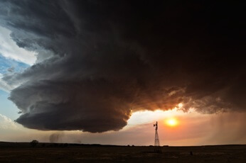 A severe thunderstorm characterized by a rotating, long-lived, intense updraft. Although not very common, they produce a relatively large amount of severe weather, in particular, extremely large hail, damaging straight-line winds, and practically all violent tornadoes.
Supercooled water
In the atmosphere, liquid water can survive at temperatures colder than 0 degrees Celsius; many vigorous storms contain large amounts of super-cooled liquid water at cold temperatures. Important in the formation of graupel and hail.
Surface-based Convection
Convection occurring within a surface-based layer, i.e., a layer in which the lowest portion is based at or very near the earth's surface. Compare with elevated convection .
Swell
Surface gravity waves on the ocean that are not growing or being sustained any longer by the wind.
Generated by the wind some distance away and now propagating freely across the ocean away from their area of generation, these waves can propagate in directions that differ from the direction of the wind, in contrast to a wind sea.
SYNOP
(from 'synoptic') In general, pertaining to or affording an overall view.
In meteorology, this term has become somewhat specialized in referring to the use of meteorological data obtained simultaneously over a wide area for the purpose of presenting a comprehensive and nearly instantaneous picture of the state of the atmosphere. Thus, to a meteorologist, "synoptic" takes on the additional connotation of simultaneity.
Synoptic Scale (or Large Scale)
Size scale referring generally to weather systems with horizontal dimensions of several hundred miles or more. Most high and low pressure areas seen on weather maps are synoptic-scale systems. Compare with mesoscale , storm-scale
TAF
This NWS aviation product is a concise statement of the expected meteorological conditions at an airport during a specified period (usually 24 hours). Each country is allowed to make modifications or exceptions to the code for use in each particular country. TAFs use the same weather code found in METAR weather reports.
TC
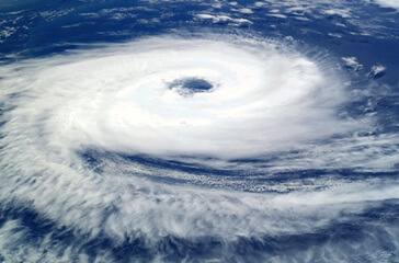 (abbr) Tropical cyclone; used in aviation reports, forecasts etc. A warm core low pressure system which develops over tropical, and sometimes subtropical, waters, and has an organized circulation. Depending on sustained surface winds, the system is classified as a tropical disturbance, a tropical depression, a tropical storm, or a hurricane or typhoon.
TCU
 Abbreviation used in the METAR/TAF code (as defined by ICAO), (Same as congestus .) A large cumulus cloud with great vertical development, usually with a cauliflower-like appearance, but lacking the characteristic anvil of a Cb . (Often shortened to "towering cu," and abbreviated TCU.)
Terrestrial radiation
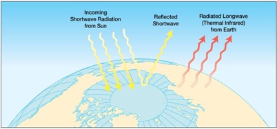 Long wave radiation that is emitted by the earth back into the atmosphere. Most of it is absorbed by the water vapour in the atmosphere, while less than ten percent is radiated directly into space.
Thermal steering
The steering of an atmospheric disturbance in the direction of the thermal wind in its vicinity; equivalent to steering along thickness lines.
For this purpose the thermal wind is usually taken from the earth's surface to a level in the middle troposphere.
Thermal wind
It is a theoretical wind that blows parallel to the thickness lines, for the layer considered, analogous to how the geostrophic wind blows parallel to the height contours. The closer the thickness isopleths, the stronger the thermal wind. Cold air is always located to the left of the thermal wind (as you face downstream) and the warm air is located on the right. Since thickness contours are tighter on the cold side of thermal wind, your lower thickness values will be found on the left side of the thermal wind. The speed and direction of the thermal wind are determined by vector geometry where the geostrophic wind at the upper level is subtracted from the geostrophic wind at the lower level.
Thermodynamic diagram
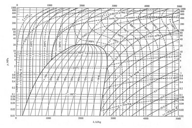 A chart containing contours of pressure, temperature, moisture, and potential temperature, all drawn relative to each other such that basic thermodynamic laws are satisfied. Such a chart typically is used to plot atmospheric soundings, and to estimate potential changes in temperature, moisture, etc. if air were displaced vertically from a given level. A thermodynamic chart thus is a useful tool in diagnosing atmospheric stability
Thickness
The thickness of a layer in the atmosphere is proportional to the mean temperature of that whole layer. The layer most often used in meteorology is between 1000 and 500 millibars. There can be different temperature profiles in the lowest layer of the atmosphere with the same 1000-500 millibar thickness value, depending on what is happening above that lowest layer. For example, if the lower levels are warming but higher levels are cooling, the overall mean temperature, the thickness, could remain the same. Likewise, on a sunny day, the amount of incoming solar radiation, affects the temperature right at the earth's surface, without necessarily having much effect on the thickness of the whole layer.
Thunderstorm
Produced by a cumulonimbus cloud, it is a microscale event of relatively short duration characterized by thunder, lightning, gusty surface winds, turbulence, hail, icing, precipitation, moderate to extreme up and downdrafts, and under the most severe conditions, tornadoes.
Thundery rain
A phrase used in weather forecasts when some quite sharp bursts of rain are expected from large areas of unstable medium cloud - with some 'rumbles' of thunder; the thunder not the most significant feature of the situation, and no well developed thunderstorms with associated hail, squally winds etc., are expected.
Thundery showers
A phrase akin to "wintry showers" which has crept into the language because many forecasts have severe word constraints. If well-developed and 'vigorous' thunderstorms are expected, then the forecast should say so, but when you only have 4 words to play with, some short-hand phraseology is necessary on a showery day with perhaps some scattered 'rumbles' of thunder.
Tilt Sequence
Radar term indicating that the radar antenna is scanning through a series of antenna elevations in order to obtain a volume scan.
Time Standard
The international meteorological community use UTC (or GMT) as the standard 'clock' for observations and forecasts. The 'day' is based on 00UTC and 12UTC, with multiples of 6 hours used for main observations. When making an observation, it is important to state what 'clock' you are using, e.g. local time, GMT, etc.
Tornado(TN)
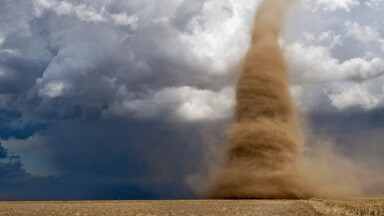 A violently rotating column of air in contact with and extending between a convective cloud and the surface of the earth. It is the most destructive of all storm-scale atmospheric phenomena. They can occur anywhere in the world given the right conditions, but are most frequent in the United States in an area bounded by the Rockies on the west and the Appalachians in the east.
Total solar irradiance
(Abbreviated TSI.) The amount of solar radiation received outside the earth's atmosphere on a surface normal to the incident radiation, and at the earth's mean distance from the sun.
Reliable measurements of solar radiation can only be made from space and the precise record extends back only to 1978. The generally accepted value is 1368 W m-2 with an accuracy of about 0.2%. Variations of a few tenths of a percent are common, usually associated with the passage of sunspots across the solar disk. The solar cycle variation of TSI is on the order of 0.1%.
Towering Cumulus
(Same as congestus .) A large cumulus cloud with great vertical development, usually with a cauliflower-like appearance, but lacking the characteristic anvil of a Cb. (Often shortened to "towering cu," and abbreviated TCU.)
Transverse Bands
Bands of clouds oriented perpendicular to the flow in which they are embedded. They often are seen best on satellite photographs. When observed at high levels (i.e., in cirrus formations), they may indicate severe or extreme turbulence. Transverse bands observed at low levels (called transverse rolls or T rolls) often indicate the presence of a temperature inversion (or cap ) as well as directional shear in the low- to mid-level winds. These conditions often favor the development of strong to severe thunderstorms .
TREND
A two-hour 'significant Weather’ forecast appended to a routine (or special) weather report intended for aviation purposes.
Triple-point
The intersection point between two boundaries (dry line, outflow boundary, cold front, etc.), often a focus for thunderstorm development. Triple point also may refer to a point on the gust front of a supercell, where the warm moist inflow, the rain-cooled outflow from the forward flank downdraft, and the rear flank downdraft all intersect; this point is a favoured location for tornado development (or redevelopment).
Tropopause
The boundary between the troposphere and stratosphere, usually characterized by an abrupt change of lapse rate.
The change is in the direction of increased atmospheric stability from regions below to regions above the Tropopause. Its height varies from 15 to 20 km in the Tropics to about 10 km in polar regions. In polar regions in winter it is often difficult or impossible to determine just where the Tropopause lies, since under some conditions there is no abrupt change in lapse rate at any height. It has become apparent that the Tropopause consists of several discrete, overlapping "leaves," a multiple Tropopause, rather than a single continuous surface. In general, the leaves descend, step-wise, from the equator to the poles.
Troposphere
That portion of the atmosphere from the earth's surface to the tropopause; that is, the lowest 10–20 km of the atmosphere; the portion of the atmosphere where most weather occurs.
The troposphere is characterized by decreasing temperature with height, appreciable vertical wind motion, appreciable water vapor, and weather. Dynamically, the troposphere can be divided into the following layers: surface boundary layer, Ekman layer, and free atmosphere.
Trough
In meteorology, an elongated area of relatively low atmospheric pressure; the opposite of a ridge.
The axis of a trough is the trough line. This term is commonly used to distinguish the previous condition from the closed circulation of a low (or cyclone), but a large-scale trough may include one or more lows, an upper-air trough may be associated with a lower-level low, and a low may have one or more distinct troughs radiating from it.
TS
(abbr) Thunderstorm (as used in aviation weather reports, forecasts etc.) Produced by a cumulonimbus cloud, it is a microscale event of relatively short duration characterized by thunder, lightning, gusty surface winds, turbulence, hail, icing, precipitation, moderate to extreme up and downdrafts, and under the most severe conditions, tornadoes.
Turbulence
Turbulence (as used in aviation weather reports, forecasts etc: e.g. MOD TURB).
The irregular and instantaneous motions of air which is made up of a number of small of eddies that travel in the general air current. Atmospheric turbulence is caused by random fluctuations in the wind flow. It can be caused by thermal or convective currents, differences in terrain and wind speed, along a frontal zone, or variation in temperature and pressure.
TVS
Tornadic Vortex Signature. Doppler radar signature in the radial velocity field indicating intense, concentrated rotation - more so than a mesocyclone . Like the mesocyclone, specific criteria involving strength, vertical depth, and time continuity must be met in order for a signature to become a TVS. Existence of a TVS strongly increases the probability of tornado occurrence, but does not guarantee it. A TVS is not a visually observable
UnderCast
In aviation, it is an opaque cloud layer viewed from an observation point above the layer. From the ground, it would be considered an overcast.
Unstable air
An atmospheric state warm air below cold air. Since warm air naturally rises above cold air (due to warm air being less dense than cold air), vertical movement and mixing of air layers can occur.
Upper Air
The portion of the atmosphere which is above the lower troposphere. It is generally applied to the levels above 850 millibars. Therefore, upper level lows and highs, troughs, winds, observations, and charts all apply to atmospheric phenomena above the surface.
Upper Level System
A general term for any large-scale or mesoscale disturbance capable of producing upward motion (lift) in the middle or upper parts of the atmosphere. This term sometimes is used interchangeably with impulse or shortwave.
Upper Ridge
(Also called upper-level ridge, upper-air ridge, high-level ridge, ridge aloft.) A pressure ridge existing in the upper air, especially one that is stronger aloft than near the earth's surface.
Upper Trough
(Also called upper-level trough, upper-air trough, high-level trough, trough aloft.) A pressure trough existing in the upper air.
This term is sometimes restricted to those troughs that are much more pronounced aloft than near the earth's surface. These troughs are often described as either short-wave or long-wave features.
Upslope Flow
Air that flows toward higher terrain, and hence is forced to rise. The added lift often results in widespread low cloudiness and stratiform precipitation if the air is stable, or an increased chance of thunderstorm development if the air is unstable.
Upslope Fog
Fog that forms when warm, moist surface air is forced up a slope by the wind. It is adiabatically cooled to below its initial dew point, which means the air cools by expansion as it rises. It forms best where there is a gradual slope, and it can become quite deep, requiring considerable time to dissipate.
Upwelling
The process by which water rises from a lower to a higher depth, usually as a result of divergence and offshore currents. It influences climate by bringing colder, more nutrient-rich water to the surface. A vital factor of the El Niño event.
V Notch
A radar reflectivity signature seen as a V-shaped notch in the downwind part of a thunderstorm echo. The V-notch often is seen on supercells, and is thought to be a sign of diverging flow around the main storm updraft (and hence a very strong updraft). This term should not be confused with inflow notch or with enhanced V, although the latter is believed to form by a similar process.
VA
(abbr) Volcanic ash: as used in aviation reports, forecasts etc. Solid material emitted during volcanic eruptions. Possible contributor to long-term weather and climate change by blocking sunlight.
VAD
Velocity Azimuth Display. A radar display on which mean radial velocity is plotted as a function of azimuth.
VC
(abbr) In vicinity: used in aviation reports, forecasts etc., e.g. VCFG, fog in vicinity but not at airfield. A proximity qualifier used to indicate weather phenomena observed between 5 and 10 statue miles (8 and 16 kilometers) of the usual point of observation, but not at the station.
Veering
A clockwise shift in the wind direction in the Northern Hemisphere at a certain location. In the Southern Hemisphere, it is counter-clockwise. This can either happen horizontally or vertically (with height). For example, the wind shifts from the north to the northeast to the east. It is the opposite of backing.
Vertically-stacked System
A low-pressure system, usually a closed low or cutoff low, which is not tilted with height, i.e., located similarly at all levels of the atmosphere. Such systems typically are weakening and are slow-moving, and are less likely to produce severe weather than tilted systems. However, cold pools aloft associated with vertically-stacked systems may enhance instability enough to produce severe weather.
Vertical Vorticity
The component of the vorticity vector along the local vertical.
References to Vorticity usually imply the vertical component of that Vorticity as a scalar quantity.
Vertical Wind Profile
A series of wind direction and wind speed measurements taken at various levels in the atmosphere that show the wind structure of the atmosphere over a specific location. Obtained through a radiosonde sounding or comparable method, and exhibited in a skew t-log p diagram.
Visibility [ reports ]
As used in SYNOP, SHIP and METAR observations: the value reported as the visibility in surface reports has for many years been the lowest visibility (as defined above) that an observer can determine. So, for example, if the general value were 6 to 9 km, but in one particular direction (say towards a major town or over adjacent coast) it was as low as 3000 m, then it would be this latter value that was recorded, e.g. 3000 m. Until 2003-2004, this was also the scheme adopted for METAR reports world-wide. However, the concept of 'prevailing' visibility has been introduced for these latter, and can be taken to be the dominant visibility (applicable to at least 50% of the local horizon, continuously or otherwise), with separate groups for significantly lower values reported as required.
Visibility [ vertical ]
Used in aviation reports to assess how far upwards a surface-based observer can 'see' through fog or snow.
Volcanic effects
It has been known for a long time that volcanic eruptions affect the environment in various ways. Whether large or small, eruptions do affect the environment for a period of time, mostly because of the gases they spew out. Many gases, like sulfur dioxide, carbon dioxide, carbon monoxide, chlorine (as HCl gas), fluorine (as HF gas), hydrogen, helium and hydrogen sulfide (H2S) are released into the environment. Along with all these comes out a huge amount of water vapor. Their effects on the environment depend on many factors like the local climate pattern, the scale on which the eruption has taken place, and the layer of the atmosphere to which the gases have spread, etc.
VOLMET
VOLMET, or meteorological information for aircraft in flight, is a worldwide network of radio stations that broadcast TAF, SIGMET and METAR reports on shortwave frequencies, and in some countries on VHF too. Reports are sent in upper sideband mode, using automated voice transmissions.
Volume Scan
A radar scanning strategy in which sweeps are made at successive antenna elevations (i.e., a tilt sequence ), and then combined to obtain the three-dimensional structure of the echoes. Volume scans are necessary to determine thunderstorm type, and to detect features such as WERs , BWERs, and overhang .
Vorticity
The measurement of the rotation of a small air parcel. It has vorticity when the parcel spins as it moves along its path. Although the axis of the rotation can extend in any direction, meteorologists are primarily concerned with the rotational motion about an axis that is perpendicular to the earth's surface. If it does not spin, it is said to have zero vorticity. In the Northern Hemisphere, the vorticity is positive when the parcel has a counterclockwise, or cyclonic, rotation. It is negative when the parcel has clockwise, or anticyclonic, rotation.
VRB
(abbr) Variable wind direction. A condition when
(1) the wind direction fluctuates by 60 degrees or more during the 2-minute evaluation period and the wind speed is greater than 6 knots; or
(2) the direction is variable and the wind speed is 6 knots or less: Variable wind direction, as used in aviation weather reports, forecasts etc.
VV
(abbr) Vertical visibility, as used in aviation weather reports, forecasts etc., e.g. VV002, vertical visibility 200ft. Where vertical visibility cannot be determined (or realistically forecast), then the group will be seen as VV///.
VWP
VAD Wind Profile. A radar plot of horizontal winds, derived from VAD data, as a function of height above a Doppler Radar . The display is plotted with height as the vertical axis and time as the horizontal axis (a so-called time-height display), which then depicts the change in wind with time at various heights. This display is useful for observing local changes in vertical wind shear , such as backing of low-level winds, increases in speed shear , and development or evolution of nearby jet streams (including low-level jets ).
This product often is referred to erroneously as a VAD .
WAFC
A World Area Forecast Centre (WAFC) is a meteorological centre that provides real-time meteorological information broadcasts for aviation purposes. These broadcasts are supervised by ICAO (International Civil Aviation Organisation) in order to fulfil requirements of the ICAO Annex 3 covering meteorological information which is necessary for flights. The role of the WAFCs is to provide meteorological messages with world-wide coverage for pilot briefing. They are usually part of the Pre-Flight Information Bulletin (PIB).
Wall Cloud
A wall cloud (or pedestal cloud) is a large, lowering cloud formation that develops beneath the base of a cumulonimbus cloud that often forms tornadoes. It is typically beneath the rain-free base (RFB) portion of a thunderstorm, and indicates the area of the strongest updraft within a storm. Wall clouds are sometimes an indication of a rotating mesocyclone in a thunderstorm, and most strong tornadoes form from wall clouds. However, wall clouds do not always rotate.
Warm advection
Transport of warm air into an area by horizontal winds. Low-level warm advection sometimes is referred to (erroneously) as overrunning. Although the two terms are not properly interchangeable, both imply the presence of lifting in low levels.
Warm anticyclone
(Or warm high; also called warm-core high, warm-core anticyclone.) At a given level in the atmosphere, any high that is warmer at its center than at its periphery; the opposite of a cold high.
Warm occlusion
A type of occluded front in which the cold air overrides the warm air. The cold front is only apparent at upper levels. Static stability decreases after passage of a warm occlusion.
Warm-front wave
A secondary disturbance, often accompanied by a shallow closed-low circulation, that forms at some point on a marked warm frontal boundary a good way (at least 1000 km) from the parent (occluding) depression. Once formed, it moves quickly away from the parent depression (in the Northern Hemisphere east or southeastwards). Although not common, they are often responsible for considerable forecast errors, and are of particular importance in winter (snow-situation) forecasting as mild, maritime air attempts to displace a cold, continental blocking anticyclone.
Warm sector
That area, within the circulation of a wave cyclone, where the warm air is found.
Traditionally, it lies between the cold front and warm front of the storm; in the typical case, the warm sector continually diminishes in size and ultimately disappears (at the surface) as the result of occlusion.
Warnings
Issued when hazardous weather or hydraulic conditions exist, are imminent or are likely to occur. Warnings are issued for conditions that poses a threat to life or property.
WBPT
(abbr) (Wet Bulb Potential Temperature, or 'theta-W') A relatively conservative property within any one air mass that is derived from the temperature and humidity values of a particular air sample for a particular level: usually 850 or 500 hPa.
Wet Bulb Potential Temperature
Wet-bulb potential temperature, sometimes referred to as pseudo wet-bulb potential temperature, is the temperature attained by mass of air brought adiabatically to saturation and then carried along moist-adiabat to 1000 mb (hPa).
Wet Microburst
A microburst accompanied by heavy precipitation at the surface. A rain foot may be a visible sign of a wet microburst.
Wind shear
The rate at which wind velocity changes from point to point in a given direction (as, vertically). The shear can be speed shear (where speed changes between the two points, but not direction), direction shear (where direction changes between the two points, but not speed) or a combination of the two.
Wintry precipitation
(often used as 'wintry showers') When the air temperature is close to zero deg.C (either side), it is sometimes easier to use this shorthand term for showers producing soft hail, sleet, snow, 'sleety-rain' etc. Frowned upon by proper meteorologists but a useful term nonetheless. (However, we try to avoid it when the showers are much heavier, and are expected to give significant snowfall.)
WS
(abbr) Wind shear, as appended to METAR reports etc. This abbreviation should only be used to indicate actual (or forecast) conditions experienced by aircraft in the atmospheric boundary layer.
ZDL
Zero-degree (celsius) Level. A somewhat better description of this variable than 'freezing' level. (q.v.)